 |
The
Roman fort of Mediobogdum stands next to the torturous road over Hardknott
Pass that once gave the Romans access from central Cumbria all the way to the coast where the River Esk and River Mite meet the sea at Ravenglass. The site covers an area of about 1.2 hectares (3 acres) with the enclosing wall standing to a height of about 3 metres with four entrances into the interior of the site located to the northeast, southeast, northwest and southwest, additionally a tower was placed in each rounded corner of the wall. Within these walls was a centrally placed headquarters building (photograph above looking west down the Esk valley) with an unfinished commandant's house adjacent to the southwest and a granary building to the northeast. No trace of the barracks remain however as the soldiers garrisoned here had to endure the wild Cumbrian hillside in more humble timber buildings. Outside of the walls to the northeast a large parade ground was leveled out of the boggy hillside while to the southeast of the fort just beside the modern path to the site are the remains of a three room bathhouse building with separate circular hot-room. The fort was built to control access to Hardknott pass sometime around 100AD during the reign of Emperor Hadrian and housed the garrison of the Yugoslavian Fourth Cohort of the Dalmatians. Their tenure here was brief and the site seems to have temporarily gone out of use by 135AD. However by the middle of the century it had been bought back into service and continued to be staffed for perhaps another 50 years before being finally abandoned. |
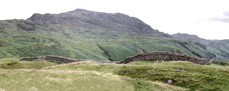 A view of the outer wall and spectacular scenery. |
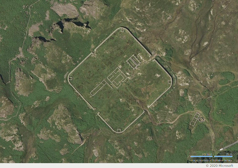 Bing satellite view of Hardknott Roman Fort. The building are from left to right; Commandant's house, Headquarters, Granary. The bathhouse and circular hot-room are towards the lower right of the image. |