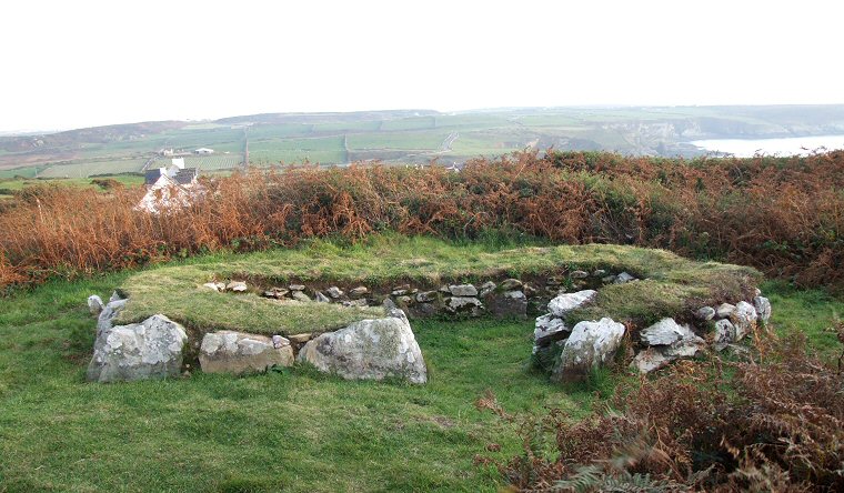
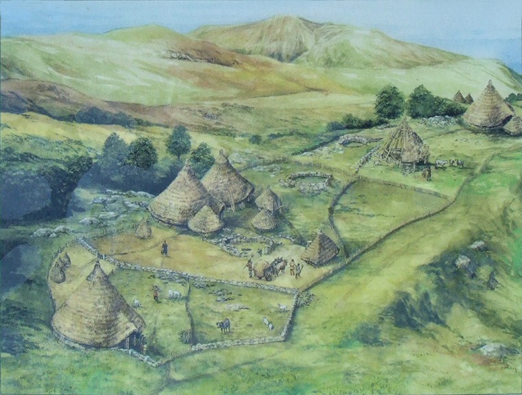
 A circular hut with the entrance to the right. |
|
The remains of the Holyhead
Mountain Hut Group - also known as Cytiau'r Gwyddelod (The Irishmen's
Huts) are located along a southwest to northeast level terrace of land
towards the south-western end of the mountain and close to the RSPB centre
at South Stack cliffs.
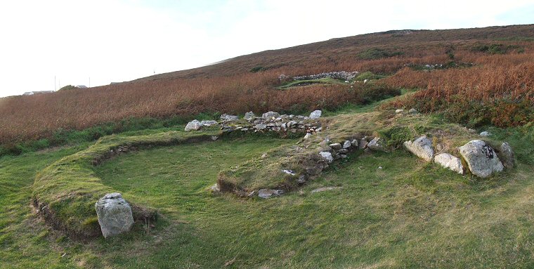
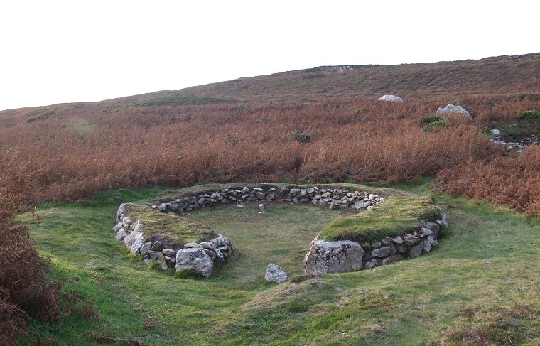
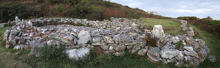
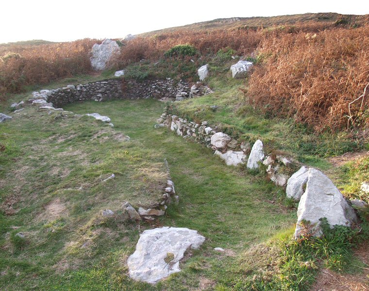
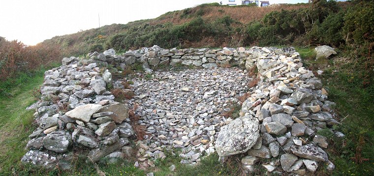
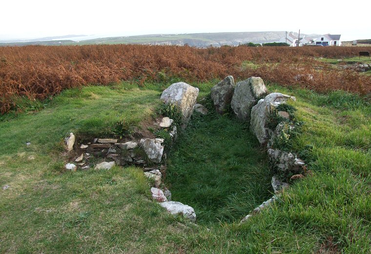
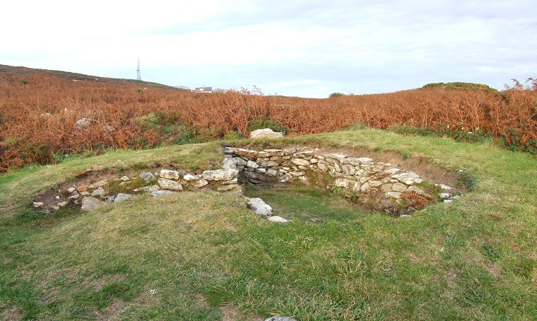
Although it is unclear how old the settlement is, with suggestions ranging from the Neolithic to the Dark Ages, it seems probable that much of it is of an Iron Age date but as the structures have been built at different periods it is possible that the local inhabitants were using the area for homesteads and farming over a much longer time span with only a handful of the buildings being in use at any one time. The site was first excavated in the 1860's when at least fifty buildings were recorded, many of the huts were then partly restored in the early 20th century. Parts of the site were re-excavated between 1978-82 and today the stone bases of twenty buildings are left for the visitor to wander around. These low stone walls would have supported the eaves of a conical roof formed from wooden poles with the larger buildings having interior wooden posts supporting the upper ends of the poles, the whole structure then being covered with thatch or turf (see similar reconstructed round houses at Flag Fen). Not all the buildings were homes or indeed circular, some were more oval with internal dividing walls, some had long entrance passages and other appear to be small but substantially built storage areas or workshops while recognisable features such as alcoves or hearths and even a stone sink can be found in some of the buildings (see pictures at the bottom of the page). Most of the buildings interpreted as houses measure between 6-10 metres across and while much of the settlement is towards the south-western end of the terrace, further to the northeast a 'farmstead' building has an adjoining stone wall forming an enclosed paddock area (to the right on the black and white plan below). Finds from the site include flint arrowheads, part of a stone axe and pottery remains that date from the late Neolithic or early Bronze Age as well as later small hoard of Roman coins found within one of the huts. |
 This building is divided by internal walls. |
 Google Earth image of the settlement site with structures marked in white on the lower section. |
     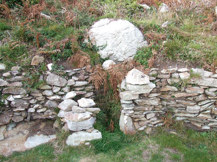 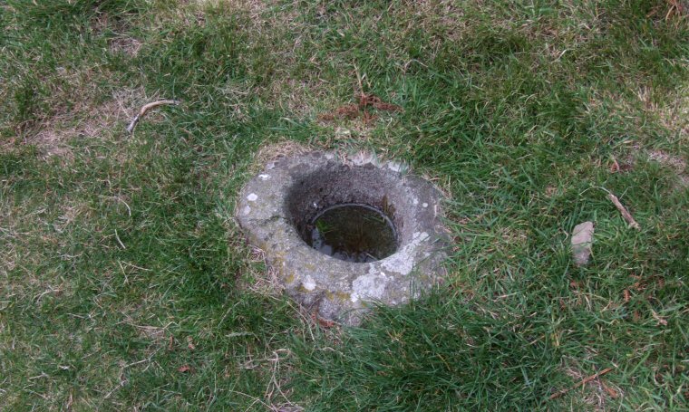     More images of the buildings at Holyhead Mountain - click to enlarge. |