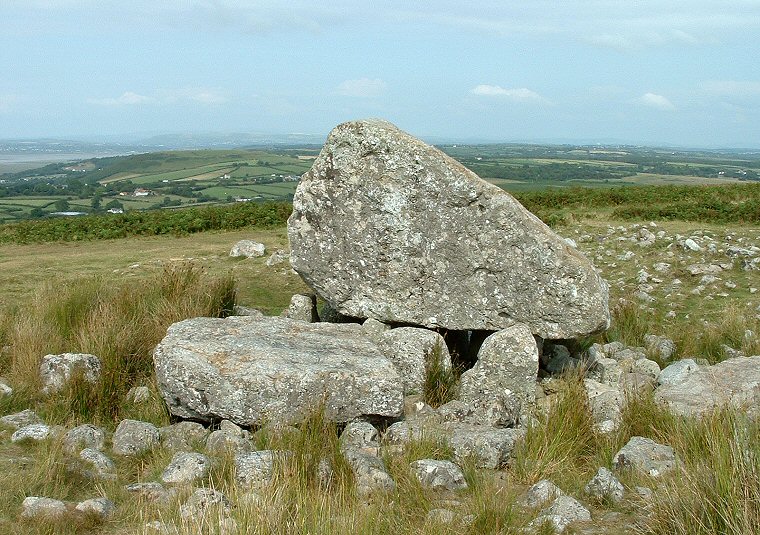
Maen Cetty looking northeast towards Cilifor Top. The large slab to the lower left is part of the broken capstone.
This chambered
cairn or burial tomb also known as Arthur's Stone, Maen Ceti or the
'Great Stone of Sketty' is one of the most well known dolmens in Wales.
Its distinctive huge capstone, which is estimated to weigh between 25-30 tons, is surrounded at its base by around ten smallish boulders but only three or four actually support its weight and it stands less than half a metre above the ground. This capstone still measures about 4 metres in length, over 2 metres in height and 2 metres wide despite the fact that it has split into two pieces with the fallen slab lying horizontally by the side of the tomb. It is thought that instead of the capstone being raised onto the supporting stones as we would normally expect, it was perhaps a natural glacial boulder standing on the ground surface that the tomb builders undermined and then used the smaller rocks as chocks or wedges to support its weight and create the internal structure of the chamber. This theory could be borne out by the slight dip in the ground level around the tomb which is now strewn with the stones that would have formed the material of the cairn. I get the impression that this cairn probably never entirely covered the tomb and indeed may not have been much higher than it is today.
The location of the tomb impressive. It stands on a northward facing slope just below the crest of the northern end of the ridge-backed hill of Cefn Bryn with fine vistas stretching east from the Iron Age hillfort at Cilifor Top, north across Llanrhidian Sands and west to the mouth of the River Loughor or Afon Llwchwr where it flows into Carmarthen Bay. It would be hard to dispute that this stunning view was not taken into account by the builders of the tomb and indeed several other simpler cairns are also spread out along the same slope, one just 100 metres away to the west is shown at the bottom of the page.
There are several legends attached to Maen Cetty - one says that it was a stone that King Arthur found in his shoe, another says that the stone sometimes goes down to the sea to drink at Port Eynon. Yet another story says that if a girl crawls around the stone three times and sees the face of her lover, then she knows that he will remain faithful to her.
Date: Neolithic
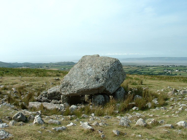
Looking northwest over the capstone towards the mouth of the River Loughor (Afon Llwchwr). The rubble remains of the cairn surrounding the tomb can be clearly seen.
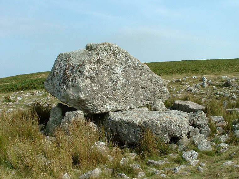
The broken off slab of the capstone now forms a step just to one side of the tomb. View looking southeast.
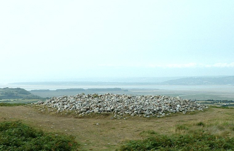
Cairn to the west of Maen Cetty looking northwest towards the mouth of the River Loughor.
