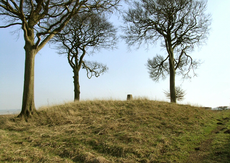
View looking southeast over Newcote Round Barrow with the Wolds on the horizon to the left.
This round
barrow stands on the western edge of the Yorkshire Wolds on the high
point of Newcote Fields with fantastic view all round from the Vale of
York in the west to the southern reaches of the Wolds to the southeast.
This commanding hilltop position may well be the reason for the location of the barrow which measures 22 metres in diameter and nearly 3 metres high, the scheduling report claims it is surrounded by a 4 metre wide ditch although this is now infilled and no trace of it remains to be seen. The barrow does not appear to have been excavated but has been pressed into service by the Ordnance Survey in the past as the location of a trig point, visible on top of the barrow in the image above.
The edges of Newcote Field itself are gouged a short distance to the northeast by Deep Dale, by Gilders Dale to the south and Warren Dale to the west and truncated to the northwest by the valley of Millington Beck.
Date: Bronze Age
References:
Pastscape 61869, NMR Number SE 85 SW 22, Record of Scheduled Monuments 21117.