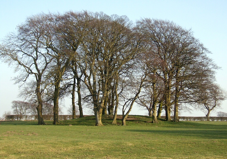
Barrow 201 at SE82755853 looking southeast.
This is one
of a small dispersed group of round
barrows that cluster around the flat topped plateau of Painsthorpe
Wold bounded on the west by the steep drop of Painsthorpe Dale with other
shallower valleys towards the north, east and south. The antiquarian J. R. Mortimer included
twenty-one barrows in his Painsthorpe Wold Group although only about half a dozen
were located on the plateau, the barrow shown above being numbered 201
in his 'Forty Years Researches...' of 1905.
It is a fairly typical Bronze Age barrow that has spread to cover a diameter of 33 metres and stands a couple of metres high and upon excavation was found to contain an adult inhumation within an oval pit and as well as five sets of cremation remains, two of which Mortimer interpreted as having been interred while the barrow mound was being constructed. The only artifacts found were a crushed food vessel recovered from the upper layer of the mound and a flint knife and bone button which accompanied one of the cremations which also had remains of some unburnt deer bones nearby.
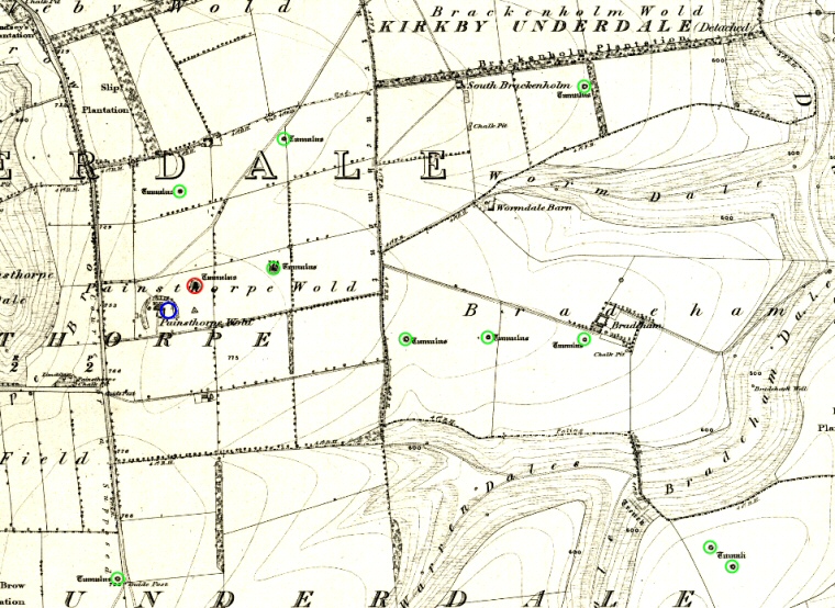
The Painsthorpe Group seems to have evolved around an earlier Neolithic round barrow (although it is not on the 1854 Ordnance Survey map below) that stood about 100 metres to the southwest of the barrow above. Again excavated by Mortimer and numbered 99 it seems that the barrow has now been flattened and possibly lies beneath agricultural buildings of Painsthorpe Wold Farm.
References:
Mortimer, J.R. 1905. Forty Years Researches in British and Saxon Burial Mounds of East Yorkshire. London: Brown & Sons.
Ordnance Survey. 1854. OS Six-inch England and Wales. Sheet 159.
Pastscape: 1257295, NMR Number: SE 85 NW 53.
