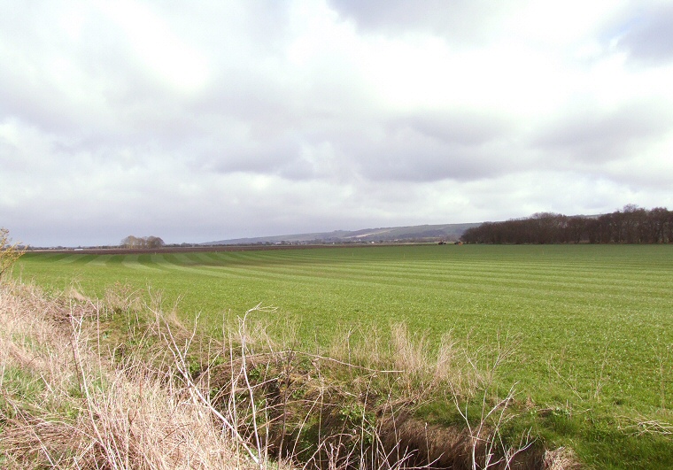
View of Star Carr looking east, the settlement site was on the slightly raised area to the left and front of the image.
An empty field hides below its surface the waterlogged remains of what was once a Mesolithic settlement standing on the eastern shores of the now vanished Lake Pickering, a glacial lake formed by meltwaters at the end of the last ice age that stretched as far west as the Hambleton and Howardian Hills towards the north of York. At this time lower sea levels meant Britain was not yet an island being still connected to the continent and as the ice retreated hunters followed herds of migrating animals across land which is now under the North Sea and began to move into new territories.
One of these that seems to have been particularly to their liking was beside Lake Pickering where they burned back the sedges and rushes on the marshy edges of its shore and laid down mats of brushwood and a trackway of split timbers to make a platform out into the clearer water - evidence of a wooden oar suggests they also used boats to move out onto the lake to fish. It is thought that the edge of the lake was not used as a habitation area but that camps would have been set up a short distance to the north on slightly raised ground. These would probably have been temporary seasonal camps and archaeologists seem to be divided on when the site would have been in use, analysis of plant remains suggests the main activity taking place here was during the summer months while finds of worked and natural deer antler suggest people were hunting here during winter.
Although animals such as auroch, elk and boar were taken as food sources it seems that red deer held a special place in the Mesolithic world view of these people. Not only were they hunted in large numbers but they are also responsible for the most famous finds at Star Carr - the antler headdresses (see images lower down). These consisted of the frontal forehead bone of red deer stags with the longer parts of the antler trimmed off and holes drilled through the bone to form either eye-holes or to tie the headdress to the wearer. What these were used for has fired the imagination of many writers (this one included) - were they worn as disguises to allow the hunters to get close to their prey or were they worn during ceremonies where perhaps a tribal leader would enter a trance state to try to commune with the spirit of the animal? Whatever their purpose it seems to have been an important one as twenty one of these headdresses where found here and it appears that they were placed into the wet areas of the site perhaps as an offerings after use. A more pragmatic reason could be they they were submerged to soften the bone prior to it being further worked and what we could be looking at is Star Carr as a production centre with the headdresses being traded further afield. This theory could be supported by the finds of nearly two hundred barbed antler points (see this image from the Natural History Museum) which would have been tied to the end of poles to make spears or harpoons for catching fish. Other finds from the site include many flint artifacts such such as scrapers, burins and microliths, pieces of worked and unworked antler and bone as well as wood working tools. Several perforated stone beads, perhaps used as jewelry, hint at the more personal lives of the occupants of the site.
At some point the site was abandoned, perhaps the settlers moved elsewhere as the level of the lake fell although luckily the ground remained waterlogged and a layer of peat slowly formed helping to preserve so much of the organic remains that make Star Carr such a unique and archaeologically rich resource. It slipped from memory until it was rediscovered in 1947 by local archaeologist John Moore and was then excavated between 1949-1951 by Sir Grahame Clark whose discoveries, particularly of the headdresses, sparked so much interest in this quiet corner of Yorkshire.
Further excavation work during the 1980's and within the last ten years have helped to shine more light on the activities that were taking place on this shore line and carbon dating of organic remains have given us a date range of activity at Star Carr of between 8770BC-8460BC suggesting that the site remained important for many generations of Mesolithic families.
Despite all that has been learned from the study of the area much remains unexcavated and the true extent of the site has yet to be discovered however recent research indicate that drainage is now threatening the very existence of Star Carr. Falling water levels mean that the water-logged peats that have protected the bone and wooden artifacts that make the site so important are now drying up leading to the decay and destruction of these irreplaceable items with some experts predicting that much will be lost within 5-10 years. To lose all that can be learned from this unique 10000 year old site would be a real archaeological tragedy.
Update: August 2010 - Archaeologists discover Britain's 'oldest house'
BBC news article on the discovery of a round house at Star Carr dating to 8500BC
Update: August 2020 - Star Carr: North Yorkshire's achaeological 'Tardis' 10 years on
An update on the above story with new pictures of the finds

Star Carr antler headdresses seen from the front and above - picture from the British Museum.

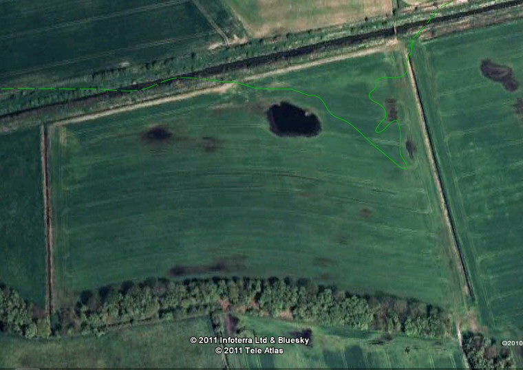
Google Earth view of Star Carr with the solid green line representing the shoreline based on the plan at www.starcarr.com with dry land lying to the north (the dashed line is purely my speculation) and the lake lying to the south of the line. Evidence of the damp conditions that have helped preserve the site can be seen from the areas of waterlogging in the field.