 Yockenthwaite circle looking southwest. The river is just beyond the wall and line of dead bracken. |
This
is a lovely little ring of stones that is probably a small stone
circle although it could equally be the kerb remains of a robbed cairn.
Whichever type of monument it originally was it's in a fantastic position on the north bank of the fledgling River Wharf, a river that was so important to the prehistoric peoples of Yorkshire. At this point in its journey the river is passing through the narrow valley of Langstrothdale with the hills of Yockenthwaite Moor to the north and Horse Head Moor to the south, a lovely spot that gives the circle the air of a small camp. The circle itself consists of about twenty-four stones in a slight oval measuring 7 metres by 6.5 metres with what could be the remains of an outer circle or kerb in the northwest quadrant (image at bottom of page) and gaps towards the northeast and southeast where presumably stones are missing. A possible outlying boulder lies about 6 metres to the southeast and there are a couple of other questionable outlying stones further away to the west. Although the circle stones are quite bulky non are more than half a metre in height while the largest stone seems to be the one closest to the river, could it be that this position was important to the people who built Yockenthwaite? Suggested Date: Bronze Age |
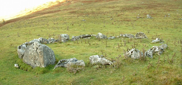 View looking northwest. The stone to the left (nearest the river) is clearly larger than the others. |
 Part of the double ring of stones in the northwest quadrant of the circle. |
Back to Map | Home | Full Glossary | Links | Email: chriscollyer@stone-circles.org.uk