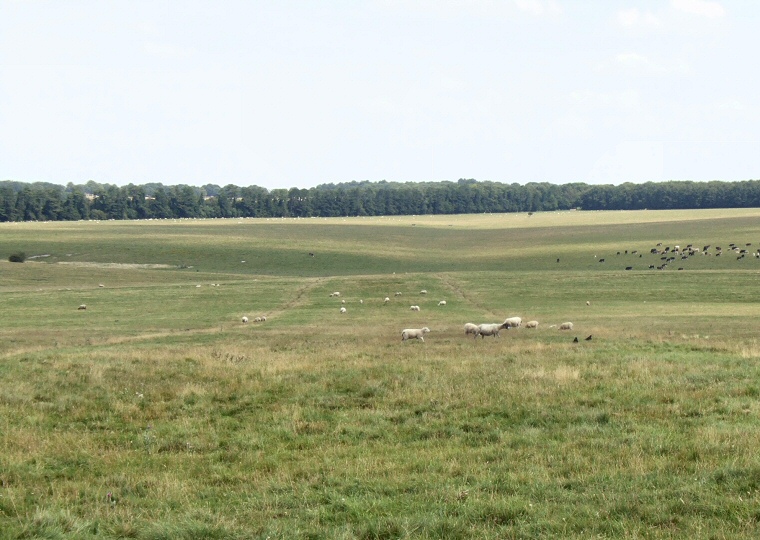
 The Stonehenge Avenue looking northeast. The parallel lines of the ditches can be seen emerging from Stonehenge Bottom in the middle of the photo and traveling towards the lower edges of the picture. |
|
Like many
other monuments in this area, the Stonehenge Avenue was first recorded
by William
Stukeley who published his research in 1740. There have been several
theories about the date of its construction and also an idea has been
put forward that it may have been built in two separate stages - it
is now believed to have been built in a single stage sometime late in
the Neolithic
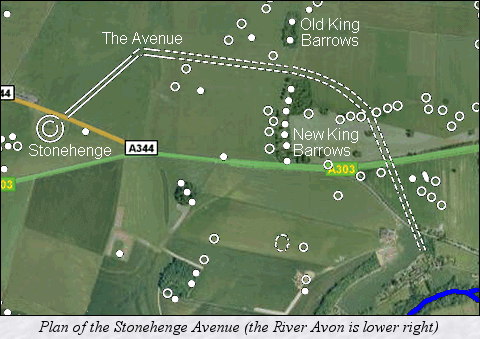
and to be contemporary with the third phase of building at Stonehenge. Starting somewhere beside the banks of the River Avon it consists of a pair of parallel banks about 34 metres apart with outer ditches and runs north-northwest for about 1 km where it then swings round to the west and  passes
through what would later become the site of the round barrow groups of the Old King Barrows and the New
King Barrows. Because of the geology of the land it is only at this
point that Stonehenge becomes visible. passes
through what would later become the site of the round barrow groups of the Old King Barrows and the New
King Barrows. Because of the geology of the land it is only at this
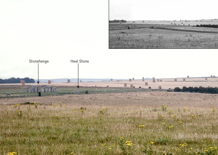
point that Stonehenge becomes visible. Taking a sharp turn to the southwest at the 'Elbow' in Stonehenge Bottom (just below the words 'The Avenue' in the plan opposite) the Avenue now runs to the north-eastern entrance of Stonehenge. By this time it has narrowed to around 21 metres for its final 500 metre approach to the stones. It is still unknown why it was built but it would seem probable that it formed a processional path and may have been built to commemorate the path the bluestones took from the banks of the Avon on their journey to the fledgeling Stonehenge. Because of farming in the area over the centuries the early parts of the Avenue are almost invisible on the ground and now only the final section is visible. It is best seen from Stonehenge as a faint pair of parallel ditches emerging from either side the Heel Stone and running northeast across the grassland (image at the top of the page). Update: 'Bluestonehenge' In 2009 excavations on the west bank of the River Avon close to the end of the Stonehenge Avenue uncovered evidence of the site of a small stone circle set within a henge bank and ditch. Excavation of nine stone holes (no stones were found) led to the estimate that there originally about twenty five stones in a circle of about 10 metres diameter with the stone phase being tentatively dated to between 3000-2500BC. The henge structure is thought to be of a slightly later date, perhaps 2400BC and measures about 25 metres in diameter. Fragments of bluestone found within some of the stone holes initially led to speculation that the stones had been removed to be reused at Stonehenge, however detailed examination by petrographer Rob Ixer has shown no match between the fragments and the bluestones at Stonehenge itself. It could be that the 'Bluestonehenge' marked a disembarkment point on the Avon either for the bluestones on their journey up the river where they were unloaded from rafts and taken along the course of the Avenue to Stonehenge or for the bodies of the dead being brought downstream from Durrington Walls before commencing a journey along the same route to their final resting places in the barrow cemeteries located around Stonehenge. |
 Telephoto picture from King Barrow Ridge. The Stonehenge Avenue is now very faint, but can be see as the two parallel lines running from the right of the Heel Stone to the right edge of the picture (see inset image). |