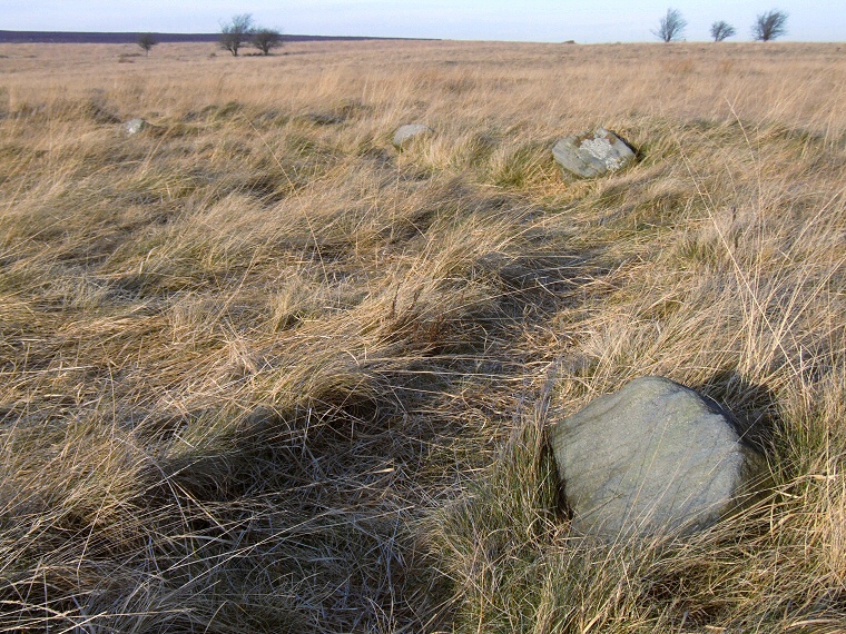
 Four stones forming part of the eastern arc of the circle. |
| The
third of the three true stone
circles on Barbrook Moor (there are also two circles which are now
thought to be ring
cairns), Barbrook III is also known as Owler Bar and stands on a plateau
in the northeast corner of the moor close to a reservoir. Looking like a secluded stone fairy-ring this Bronze Age circle almost seems to disappear beneath clumps of grass during the summer as the tallest stone is little more than half a metre in height. Despite the small stature of the stones it is actually one of the largest circles in Derbyshire, consisting of a flattened circle of twenty-one remaining stones set within a very faint bank, the diameters of the ring being 26 metres by 24 metres. It is suggested by Victoria and Paul Morgan that there are three breaks in the bank and that one to the east-northeast may have formed an entrance. There are fine views from the southeast round to the northwest but the height of the stones make photographing the site tricky, and finding in the first place can be just as difficult. To reached it, park on the east side of the moor near to the junction of the A621 and Owler Bar roundabout. From here follow a track westwards that leads to the reservoir. After about 500 metres, a track leads off to the north - take this and continue on for around 300 metres, the circle is now a short distance away to your west. Note: The OS 1:25000 and 1:50000 maps show a ring of dots next to the text 'Stone Circle' - these are incorrectly marked. The circle is in fact a short distance to the south east at the grid reference given at the top of this page. *Update 2008* It appears that the entrance onto the moor suggested above currently has a sign prohibiting parking. An alternative is to park in the large lay-by on the A621 to the west of Ramsley Lodge and take a pleasant (if long) stroll along the track that leads past both Barbrook I and Barbrook II towards the reservoir. From here follow a track northwards for about 300 metres and look for the stones a few metres to your right. A shorter more direct route involves parking by the side of the B6054 and following a track south. |
 A bleak January 1999 on Barbrook Moor looking southeast |
