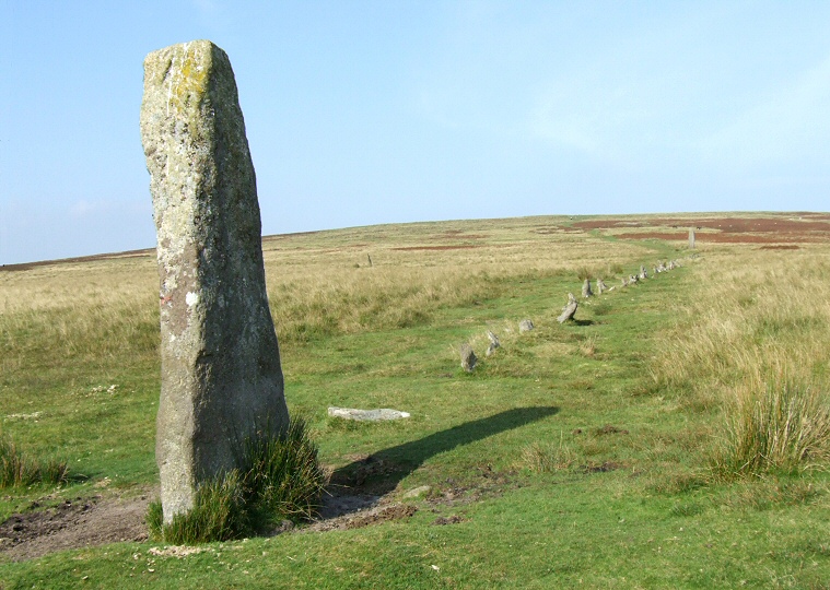
 The southern row looking uphill from the terminal standing stone |
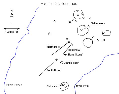 The
Drizzlecombe complex of monuments stand on a spur of land sandwitched
between the stream of Drizzle Combe and the River Plym to the southwest
of Dartmoor in an area rich with prehistoric remains which was obviously
a focus of much activity during the Bronze
Age. This spur which leads southwest downhill from Hartor Tor contains
five enclosed settlement sites
and huts as well as many cairns
and a cist
but it is the three stone rows and their tall terminal stones that dominate
the landscape today. The
Drizzlecombe complex of monuments stand on a spur of land sandwitched
between the stream of Drizzle Combe and the River Plym to the southwest
of Dartmoor in an area rich with prehistoric remains which was obviously
a focus of much activity during the Bronze
Age. This spur which leads southwest downhill from Hartor Tor contains
five enclosed settlement sites
and huts as well as many cairns
and a cist
but it is the three stone rows and their tall terminal stones that dominate
the landscape today. All three rows run gently uphill along the spine of the spur in a roughly southwest to northeast direction with their terminal stones at the southern end and a cairn marking their northern limits. The terminal stone of the eastern row is said to be the largest on Dartmoor and stands 4.2 metres tall after it was re-erected in the late 19th century and is a curiously shaped thin monolith sometimes know as the 'Bone Stone' (photograph below right) although it could also said to resemble a flag or the tail of a fish. From the Bone Stone a single stone row emerges consisting of about a dozen small uprights all less than half a metre tall that lead to a damaged cairn surrounded by a circle or kerb of low stones. This cairn is nothing spectacular and measures 9-10 metres in diameter and about a metre high with a crater in its summit as evidence of possible antiquarian excavation or rifling for treasure. A few metres to the northwest is another robbed cairn of almost identical size but with a kerb consisting of just seven stones which marks the northern limit of the northern row. This is also a single row but with about seventy stones stretching out over 150 metres is more substantial than its neighbour although the stones here are smaller and more overgrown in places with a shorter southern terminal that stands about 2.4 metres tall and as such it is less distinct in the landscape. The final row of the three (the southern row) starts a short distance from the southern end of the eastern row, again this is marked with a robbed cairn measuring about 7 metres in diameter and nearly a metre tall but with its kerb of stones partly covered with earth from the mound. The row that leads 150 metres southwest from the cairn starts off as a single, then becomes a double before returning to just a single again, all the stones are fairly small at less than half a metre and there are reckoned to be about seventy standing with a further half dozen fallen - the row terminates with a narrow 3 metre tall blocking stone (see photograph above). All three rows are presumably fairly contemporary with each other but one monument that stands close-by seems out of place. Just to the southeast of the gap between the eastern and southern rows is a massive cairn known as the Giant's Basin (bottom photograph) that has a diameter of 22 metres and stands about 3 metres tall. This huge rubble mound was obviously a tempting target for early excavators or treasure seekers as a large crater extends into the centre which must have removed nearly a metre from its height and what, if anything, was found is not recorded. The Giant's Basin seems at odds with the rest of the cairns in the surrounding area and the stone rows are not aligned on it which could point to it being a founding monument or possibly a later addition to the Drizzlecombe landscape. |
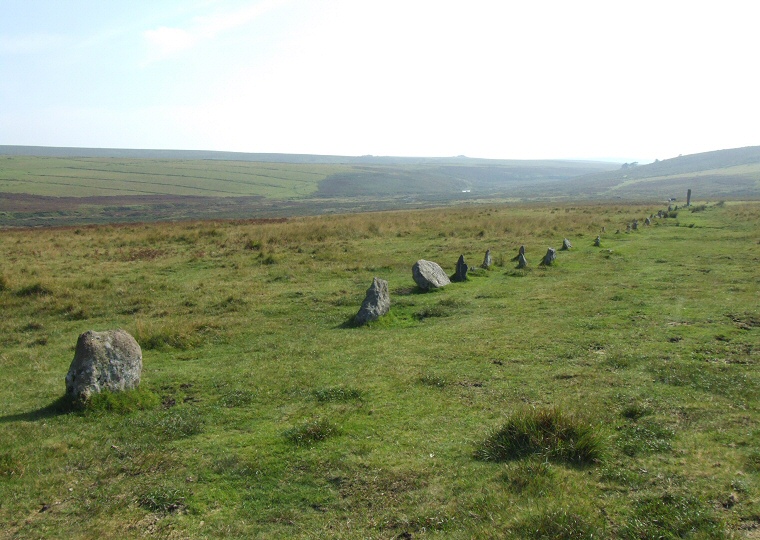 The southern row looking southwest |
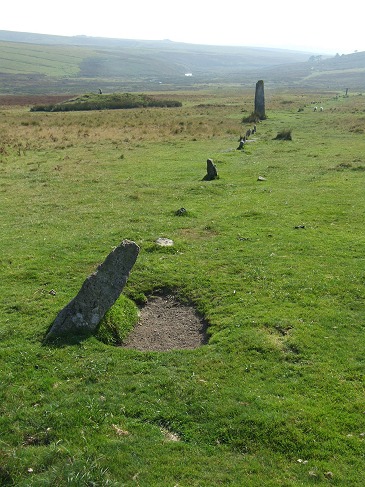 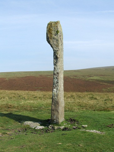 Left: The eastern row looking southwest with the Giant's Basin cairn to the upper left and terminal stone upper right. Right: The 'Bone Stone', the terminal stone of the eastern row. |
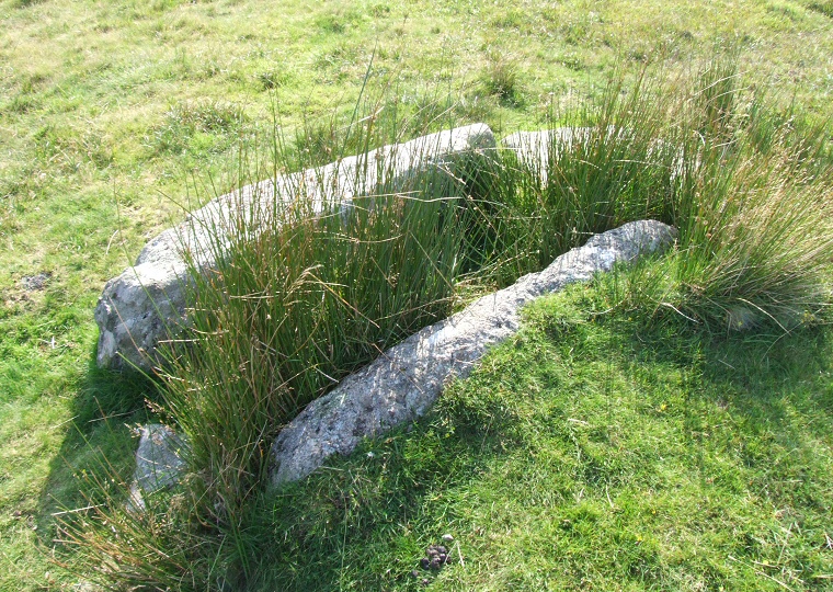 The stone slabs of a possible cist to the south of the rows. |
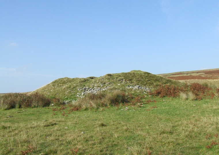 The damaged remains of the Giant's Basin cairn. |
Back to Map | Home | Full Glossary | Links | Email: chriscollyer@stone-circles.org.uk