|
A track leads across
the northwestern corner of Gibbet Moor and a few metres north of this track are
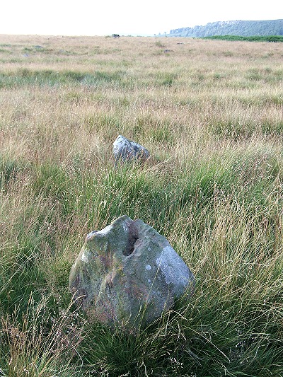
a couple of small standing stones. Nothing remarkable, until you raise your eyes
to the slight rise in the ground to the north-northwest where a large boulder stands
80 metres away on the skyline - it then becomes apparent that these three stones
stand in alignment.
The two smaller stones in the foreground of the photograph measure about half a metre in height and stand a couple of metres apart and it is possible that another pair of stones are now missing which together formed a similar type of monument to the nearby 'four poster' that lies 500 metres away due south. However it is equally possible that this three stone alignment was deliberate with either some kind of ritual purpose or simply part of a Bronze Age field boundary. If we draw an imaginary line through the alignment we find that it extends north-northwest just below, and following the line of, Birchen Edge, across the top of Gardom's Edge, shaving the western edge of Swine Sty and then onto White Edge passing several contemporary settlement, farming and funerary areas. Several other stones stand nearby and it has been suggested that these may also form alignments. |
|
Back to Map | Home | Full Glossary | Links | Email: chriscollyer@stone-circles.org.uk