This area of south-west Wales is rich in prehistoric burial
chambers, cairns and standing stones and on a flat plateau of rough pasture just to the west of a minor road leading from Mynachlog-ddu to Llandre-Isaf stands the beautiful stone
circle of Gors Fawr. The name
translates as 'great wasteland or marsh' and not as one might suspect a reference to the numerous gorse bushes that dot the site making photography difficult.
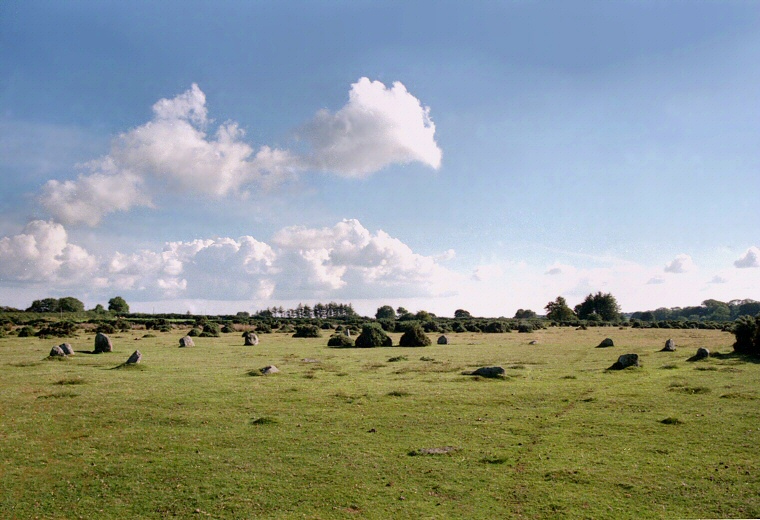
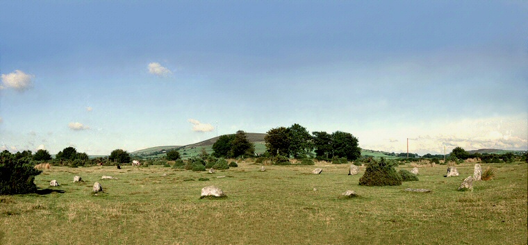
The circle consists of a 22 metre ring of sixteen low stones and although their height gradually rises towards the south of the circle the tallest stones only reach about 1.4 metres in height. As a consequence the site sits fairly inconspicuously in the modern landscape as it probably did when it was constructed either in the late Neolithic or early Bronze Age. There is a suggestion that an entrance existed on the eastern side of the circle while two fallen outlying stones, one a little further east and one to the west may have been related to the circle.
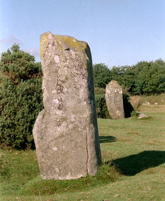
At a distance of 134 metres to the northeast are a pair of standing stones - one of which is known locally as the 'Dreaming Stone' - that may have been physically linked to the circle by a stone avenue. Both of these outliers are taller than the circle stones with one measuring 1.9 metres and the other 1.7 metres in height. The pair are set 14 metres apart and could be said to form a southwest to northeast alignment which has lead some to suggest that they could point to the midsummer sunrise over the nearby hill of Foel Dyrch.
The location of this circle is particularly interesting as it lies just to the south of the Preseli Mountains - these hills being the place where the famous Stonehenge bluestones of various types of dolerite originated and particularly the prehistoric stone quarries around Carn Meini (variously marked as Carn Menyn or Carnmenyn on OS maps). This rock outcrop is located just 2 miles (3.2km) to the north-northeast of the circle but despite the close proximity to the source of these supposed sacred stones the builders of Gors Fawr mainly chose local glacial erratic boulders for their circle. The exact number of dolerite stones in the circle is not clear, some sources suggest just a single stone while others suggest it may be as many as eight. The reasons for their preference will never be known but it could be that Carn Meini rock was not viewed as having any special significance by the local population being after all familiar local stone or perhaps the circle dates from a slightly different period when either the bluestones had not gained, or had lost, their significance.

Gors Fawr circle looking east-northeast towards the hill of Foel Dyrch.

The two outlying stones, looking northeast.
Site Visit / Photographs:
August 2000.
References:
Barber, C. and Williams, J. G. 1989. The Ancient Stones of Wales. Abergavenny: Blorenge Books
Burl, A. 1976. The Stone Circles of the British Isles. London: Yale University Press.
Burl, A. 1995. A Guide to the Stone Circles of Britain, Ireland and Brittany. London: Yale University Press.
Burnham, A. (Editor). 2018. The Old Stones. The Megalithic Portal. London: Watkins.
Cope, J. 1998. The Modern Antiquarian. A Pre-Millennial Odyssey through Megalithic Britain. London: Thorsons.
Hawkes, J. 1986. The Shell guide to British Archaeology. London: Michael Joseph Ltd