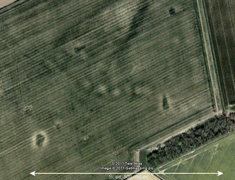
This Google Earth image shows a line of six circular cropmarks running across the centre of the picture that correspond to the approximate positions of the barrows.
This collection
of round
barrows forms the northmost of three Bronze
Age cemeteries that run in a rough line southeast to northwest on
the eastern side of Newbald Lodge (the other two being Newbald
Lodge and Littlewood).
Each of these clusters stands on its own small hill and together with a handful of other barrows that remain close by they must mark what was an important ceremonial area for the prehistoric population of the area, indeed this importance seems to have continued over a long period of time as a rich Iron Age cemetery existed just a short distance to the northwest at Arras.
The Ordnance Survey map of the area from 1905 shows ten barrows in this group while English Heritage's list of scheduled monuments lists seven remaining. However, when I visited the site I found it just about impossible to discern any recognizable mounds in the ploughed field - hence the satellelite image instead of photographs. The measurements given by EH tend to support this observation, they are as follows:
0.2m high by 20m diameter
0.4m high by 20m diameter
0.15m high by 20m diameter
0.1m high by 20m diameter
Plus three further barrows that measure between 0.1m - 0.15m high and 15m in diameter.
Several of the barrows were excavated by the antiquarian Canon Greenwell in 1866 when he found a mixture of burials, cremations placed in shallow holes and cremations remains contained in inverted urns.