The Hole of
Horcum is a massive natural amphitheatre that was carved out of the rock
of the North Yorkshire Moors by the action of glacial ice flows - an interesting
place in itself but also the location of much activity during the prehistoric
period.
It is situated at the western end of the ancient trackway known as the 'Old Wife's Way' which leads east towards Blakey Topping and it is also the location of several Bronze Age dyke (or 'dike') earthworks and round barrows as well as settlement sites further to the southwest on Levisham Moor.
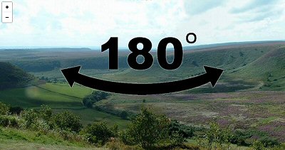
One of these dykes is Gallows Dike which consists of a 3 metre wide and roughly 2 metre deep ditch with eroded 4 metre wide banks that runs roughly north to south over a small raised section of land close to a kink in the A169 road on Saltergate Moor (photograph below). There are three round barrows close by and it is possible that as well as being burial monuments they could also have served as territorial markers - they are probably slightly later in date than the bank and ditches.
There are also several cross dykes running northwest to southeast further to the southwest beyond the Hole of Horcum and these also have round barrows nearby or associated with them. A much damaged series of banks and ditches known as Horcum Dikes also run north-south along the east side of the glacial hollow.
To the southwest of Levisham Moor there are several burial mounds and further later Iron Age earthworks, there are also associated field systems and enclosed settlement areas, one of which showed evidence of being involved in iron making and thought to have been in use well into the Roman period.
It is situated at the western end of the ancient trackway known as the 'Old Wife's Way' which leads east towards Blakey Topping and it is also the location of several Bronze Age dyke (or 'dike') earthworks and round barrows as well as settlement sites further to the southwest on Levisham Moor.
One of these dykes is Gallows Dike which consists of a 3 metre wide and roughly 2 metre deep ditch with eroded 4 metre wide banks that runs roughly north to south over a small raised section of land close to a kink in the A169 road on Saltergate Moor (photograph below). There are three round barrows close by and it is possible that as well as being burial monuments they could also have served as territorial markers - they are probably slightly later in date than the bank and ditches.
There are also several cross dykes running northwest to southeast further to the southwest beyond the Hole of Horcum and these also have round barrows nearby or associated with them. A much damaged series of banks and ditches known as Horcum Dikes also run north-south along the east side of the glacial hollow.
To the southwest of Levisham Moor there are several burial mounds and further later Iron Age earthworks, there are also associated field systems and enclosed settlement areas, one of which showed evidence of being involved in iron making and thought to have been in use well into the Roman period.

View looking north along a section of Gallows Dike.