Situated on
the eastern edge of the larger Beeley Moor, Holy Moor is a small eastward
sloping piece of land above the valley of the River Hipper. It is an enclosed
farming area with many drystone walls with small fields grazed by sheep
while others have been left as rough moorland. In one of these moorland
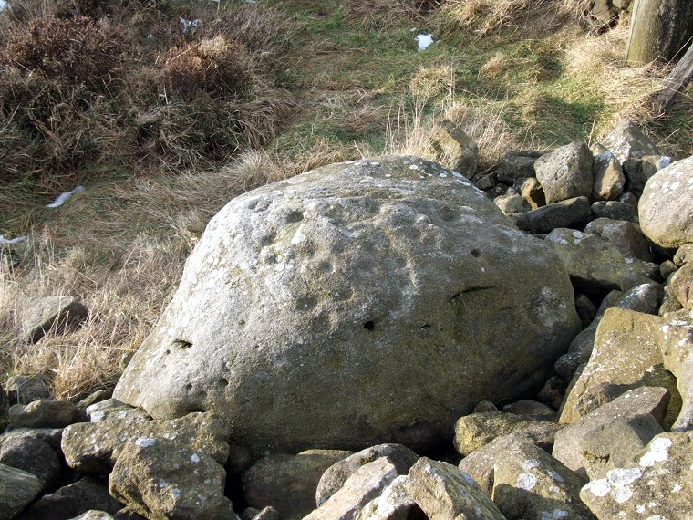
enclosures close to a field wall and stile is this cup
marked rock beside a large area of field clearance cobbles, it is
not known if this is the original location of the rock or whether it was
moved here as part of the clearance operation. On its rounded top and
down the side facing the camera above are around 40 worn cup marks (compare
this stone with the Pepperpot on Ilkley Moor)
and it is possible that one or more of these cups are surrounded by eroded
rings, it is also possible that if the stone has been moved then there
could be more carvings on the base that have yet to be discovered.
Suggested Date - Bronze Age
Suggested Date - Bronze Age