
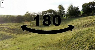
Looking west towards Tun Dale over the western section of Huggate Dykes with the later causeway in the foreground.
The earthworks of Huggate Dykes (or Dikes) on Huggate Pasture form part of a large series of prehistoric banks and ditches that can be found across East Yorkshire, cumulatively these earthwork features stretch across 80-100 miles of the high ground of the Wolds although many have been ploughed away and are now only recorded as crop marks from aerial photography.
What their purpose was is not fully known although it would seem unlikely that their relatively low height gave them much of a defensive role and it would seem more probable that they formed a series of territorial boundaries between different family or tribal groups.
Many of the earthworks consisted of single or double sets of banks and ditches that followed the brows of hills over considerable distances but some shorter sections could have many more sets of earthworks. These often formed 'cross-ridge dykes' as J. R. Mortimer notes in 1905
"... another prominent feature in their construction is the great number of parallel ditches and ramparts displayed in crossing a neck of high ground from the narrow end of one valley to that of the adjoining one, as at Huggate Pasture".
In the case of Huggate these valleys are the junction of Tun Dale and Frendal Dale to the west and valley of Horse Dale to the east. In Mortimer's time the earthworks consisted of a maximum of seven ditches with six banks (see plan below) although this has now been reduced by modern tracks and field boundaries and an eastern section across flatter ground has been completely destroyed by ploughing and only visible as a line of five or six cropmark ditches recorded by Stoertz.
The dating of earthworks like Huggate is not straightforward, they may have their origins in the middle Bronze Age and then continued to be extended and remodelled in later times although it is thought that their main construction and use phase was probably during the Iron Age, indeed a single piece of early Iron Age pottery was recovered from a ditch section during excavation of the site in the 1970's.

Image taken from the same place as above but looking northeast over the eastern section of the earthworks.

Google Earth image of Huggate Dykes. The visible banks and ditches are located to the left of the white trackway while to the right they are just about visible as crop marks extending parallel to the track in the direction of the road at the far right of the picture.
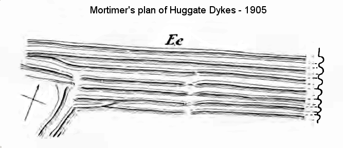
Mortimer's plan and section of Huggate Dykes from 1905 (Plate C Page 375).
Darvill, T. 2010. Prehistoric Britain. 2nd Edition. Abingdon: Routledge.
Dent, J.S. 2010. The Iron Age in East Yorkshire. British Archaeological Reports 508. Oxford: John and Erica Hedges Ltd.
Mortimer, J.R. 1905. Forty Years Researches in British and Saxon Burial Mounds of East Yorkshire. London: Brown.
Stoertz, C. 1997. Ancient Landscapes of the Yorkshire Wolds. Aerial photographic transcription and analysis. RCHME.
NMR Number: LINEAR 336. EH/Defra National Monument Number: 26574. Pastscape: 1040086.