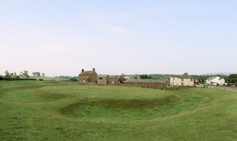
 King Arthur's Round Table. Mayburgh Henge can be seen on the horizon to left of the picture. |
| The henge monument
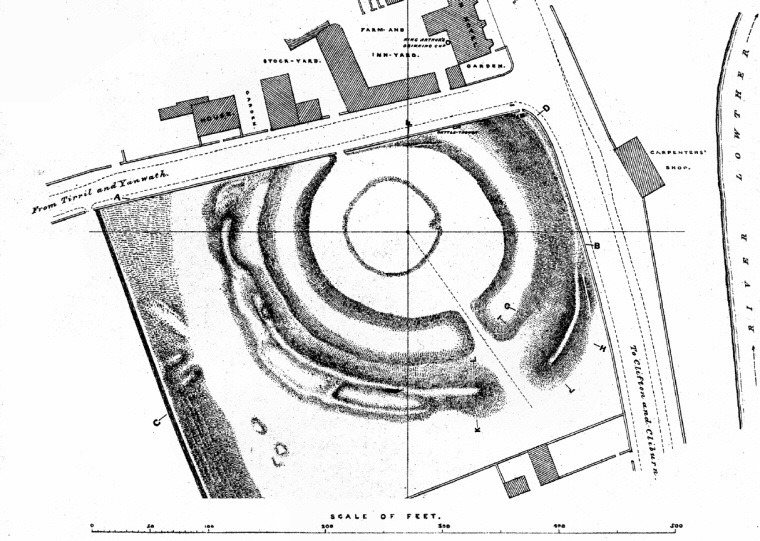
known as King Arthur's Round Table is located at the southern edge of Eamont Bridge, a small settlement which lies to the south of the town of Penrith and within earshot of the M6 motorway less than 300 metres to the southwest. Dating from the late Neolithic it consists of a central roughly circular raised area about 50 metres in diameter accessed by a causeway 3.5 metres wide that extends towards the southeast (to the lower left of the photograph above which shows the view looking northwest). This causeway passes over a ditch with a width that varies from 12 metres to 16 metres and a depth of roughly 1.5 metres, it then continues across a leveled berm 7 metres wide (lower left corner above) where it joins the 7.5 metre wide entrance through the bank. The bank measures between 10 -12 metres wide giving it an outer diameter of around 90 metres and stands to a maximum height of 1.7 metres in places falling away to just over half a metre at its lowest point - traces of the bank can be seen on the middle left of the picture. Unfortunately most of the northern part of the monument beyond the central area and a section of the eastern arc of the bank has been lost after 19th century building work and the construction of the roadway and nearby farm buildings and Crown Hotel. This destruction also included a north-western entrance which was presumably similar to the one now remaining - in Dymond's survey of the site in 1889 shown below there is still just about a suggestion of the northern causeway just to the south of the road. A slightly raised area shown in the middle of the drawing is thought to be a more recent embellishment. The monument itself is the central of three henge earthworks that stand in a triangle of land to the west of the confluence of the Rivers Lowther and Eamont, the henge to the south (the Little Round Table) having been all but destroyed and the other, the huge Mayburgh Henge, standing about 400 metres away to the west. It is interesting that although these three monuments are not in a straight line King Arthur's Round Table is clearly visible through the entrance of Mayburgh Henge and there can be no doubt that they were in some way linked physically and spiritually in the minds of the prehistoric population of the area. |
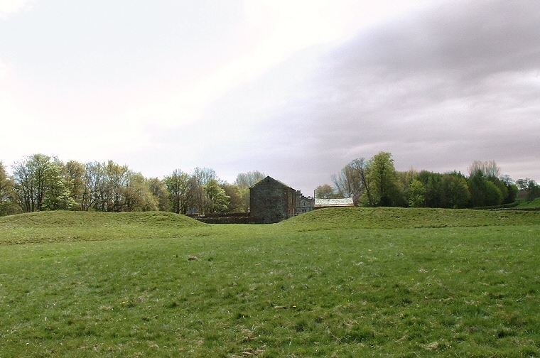
 View of the bank and entrance looking southeast from the centre of the henge |
 Plan of King Arthur's Round Table by C. W. Dymond, dated 1889. The scale bar of 500 feet is about 150 metres. |