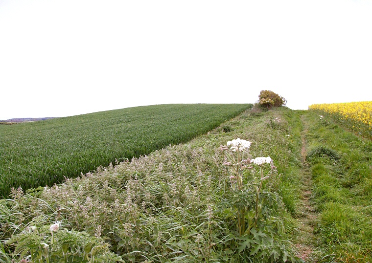
Looking south over Metlow Hill Round Barrow from beside the track leading from Bempton Cliffs.
This isolated
round barrow stands on the south-eastern slopes of a small plateau of land
to the northeast of Bempton village looking across farmland towards the
earthwork banks and ditches of Danes Dyke
a kilometre (0.6 miles) to the southeast and the headland of Flamborough
another 5 kilometres (3 miles) further on.
Although it has been spread by plough action over the years to a diameter of nearly 30 metres it still stands a respectable 1.5 metres tall and is a prominent feature in the landscape particularly when approached along a permissive trackway that links Blakehow Lane with Bempton Cliffs, indeed the track passes over the western edge of the barrow, as can clearly be seen in the image above. An encircling 3 metre wide ditch, now filled with soil, has been recorded as a soilmark in aerial photographs.
The barrow was excavated by Canon Greenwell sometime between 1877 and 1889 who noted that an arc of stones were found beneath the mound which he likened to the remains of a stone circle although it is possible that they formed part of a revetment kerb around an earlier barrow that was subsequently enlarged. At the centre of the mound a 1.5 metre long east-west grave had been cut 80cm deep and lined with planks in which the body of a child between 5-6 years old had been interred along with a food vessel, further planks had then apparently been placed over the burial to seal the grave.
No other human remains were discovered but a further food vessel was found some distance from the grave on what would have been the original ground surface along with the remains of a further unspecified pottery vessel that had damaged in the recent past. Within the mound Greenwell also found sixteen flint scrapers, three flint knives and three flint saws along with many other flakes that may suggest the items had been worked on the spot for inclusion within the barrow. Also recovered were a quartzite pounding stone and the remains of a broken Neolithic arrow head.
Date: Bronze Age
Greenwell barrow number CCLIII.
RCZA Reference: BE28.
References:
Brigham, T., Buglass, J., George R. 2008. Rapid Coastal Zone Assessment Yorkshire and Lincolnshire. Humber Field Archaeology
Greenwell, W. 1890. Recent Researches in Barrows in Yorkshire, Wiltshire, Berkshire etc. In Archaeologia. Vol. 52. pp1-72.
Pastscape: 81830, NMR Number: TA 27 SW 1, Schedule Number: 26511