Like many of the sites in this area,
the Pike of Stickle axe factory is set in beautiful natural surroundings. The
Pike itself is a towering conical peak that rises over 690 metres above sea level
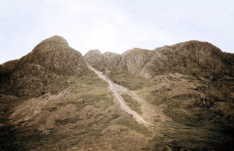
and 560 metres above the Cumbria Way as it follows the course of the valley of Mickleden Beck. The image above is the view looking north from the valley with the Pike of Stickle to the left and Gimmer Crag to the right.
Below the summit on the southeastern side of the hill Neolithic workers quarried and roughly shaped the volcanic 'greenstone' rock into blanks that were traded around the country. Some of these blanks, that would have been used for making axe heads, have been found as far away as Cornwall and Wessex in the south, up to Scotland in the north. Traces of their labours can be still be seen above in the scree slope formed from their quarry spoil that runs down from the Pike into the centre of the picture.
Just under three miles away to the southeast at Chapel Stile is another site that may have been linked to the Cumbrian axe trade. The large boulder of Copt Howe has a complex series of carvings that have been suggested could represent either a literal or symbolic prehistoric map of the Great Langdale area.