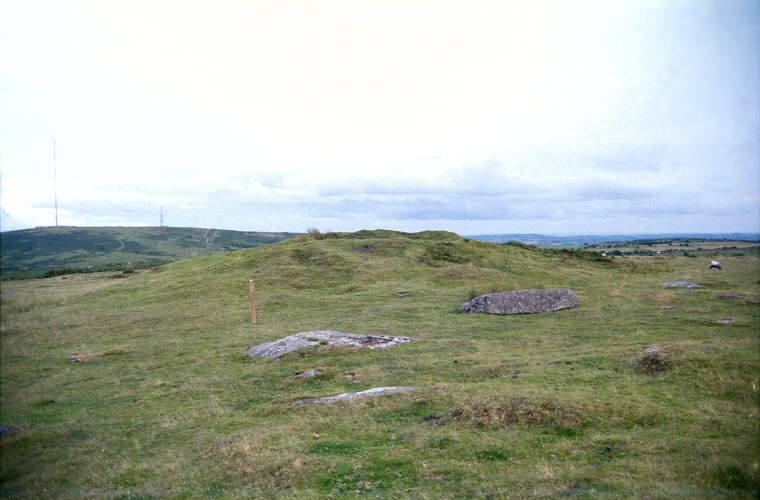
Rillaton Barrow - looking southeast across Minions towards Caradon Hill
This round
cairn stands 500 metres north-northeast of The
Hurlers stone
circles on a rise of land known as Rillaton Moor in an area rich in
round
barrows, cairns, standing stones and natural rock features.
It consists of a mound of stone and earth that has a diameter of over 35 metres and stands over 2.5 metres high despite a crater dug into its top by stone robbers.
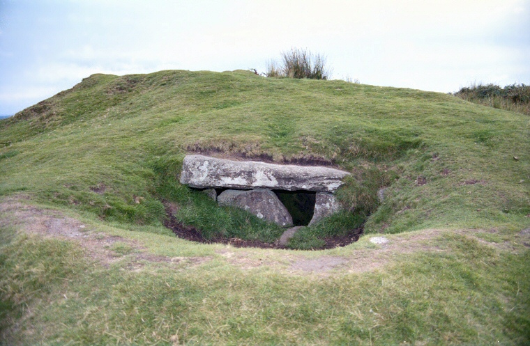
What is most interesting though is a slab lined cist
on its eastern side and what it was found to contain. This cist which is
aligned north-south and is about 2 metres long by 1 metre in width and height
was opened by in 1837 by workmen looking for building material who found
a skeleton along with a bronze
dagger, several faience
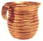
beads and a decorated pot that contained a corrugated gold cup with a riveted
handle. This spectacular find, now known as the Rillaton Cup and thought
to date from 2000-1500BC, was handed over as treasure trove and found its
way into King George V's dressing room where he is said to have used it
for storing collar studs! It is currently in the British Museum and was
thought to be unique in Britain until a similar but partly crushed gold
cup was found at Ringlemere in Kent in 2001.
Date: Bronze Age
It consists of a mound of stone and earth that has a diameter of over 35 metres and stands over 2.5 metres high despite a
 crater dug into its top by stone robbers.
What is most interesting though is a slab lined cist
on its eastern side and what it was found to contain. This cist which is
aligned north-south and is about 2 metres long by 1 metre in width and height
was opened by in 1837 by workmen looking for building material who found
a skeleton along with a bronze
dagger, several faience
beads and a decorated pot that contained a corrugated gold cup with a riveted
handle. This spectacular find, now known as the Rillaton Cup and thought
to date from 2000-1500BC, was handed over as treasure trove and found its
way into King George V's dressing room where he is said to have used it
for storing collar studs! It is currently in the British Museum and was
thought to be unique in Britain until a similar but partly crushed gold
cup was found at Ringlemere in Kent in 2001.
crater dug into its top by stone robbers.
What is most interesting though is a slab lined cist
on its eastern side and what it was found to contain. This cist which is
aligned north-south and is about 2 metres long by 1 metre in width and height
was opened by in 1837 by workmen looking for building material who found
a skeleton along with a bronze
dagger, several faience
beads and a decorated pot that contained a corrugated gold cup with a riveted
handle. This spectacular find, now known as the Rillaton Cup and thought
to date from 2000-1500BC, was handed over as treasure trove and found its
way into King George V's dressing room where he is said to have used it
for storing collar studs! It is currently in the British Museum and was
thought to be unique in Britain until a similar but partly crushed gold
cup was found at Ringlemere in Kent in 2001.Date: Bronze Age

The stone lined cist on the eastern side of the cairn