
There are (or were)
three stone
circles in this area overlooked to the west by the hills of the Shap Fells, the Ralfland Forest and Bampton Common which stand beyond the valley of the River Lowther, the circles of Shap South (Kemp Howe or Shapsey), Shap Centre (Gunnerkeld) and Shap North (Wilson Scar).
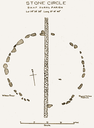
Kemp Howe (photographs on this page) is the most accessible of the three circles but is badly damaged by having been bisected by the Preston-Carlisle mainline railway with only six large stones still in situ. It may originally have been around metres in diameter had not 19th century railway technology so rudely disturbed it.
Gunnerkeld, about 3 miles to the north of Kemp Howe, consists of two concentric circles, the outer circle has a couple of stones standing of the eighteen remaining and measures approximately 30 metre across. The inner circle is much better preserved with around thirty stones remaining measuring 15 metres in diameter and containing a burial mound and damaged cist. It stands on private land and permission must be sought before visiting it (unfortunately there was nobody home when I visited so I have yet to see the circle at first hand although it can be seen from the southbound carriage of the nearby M6 motorway)
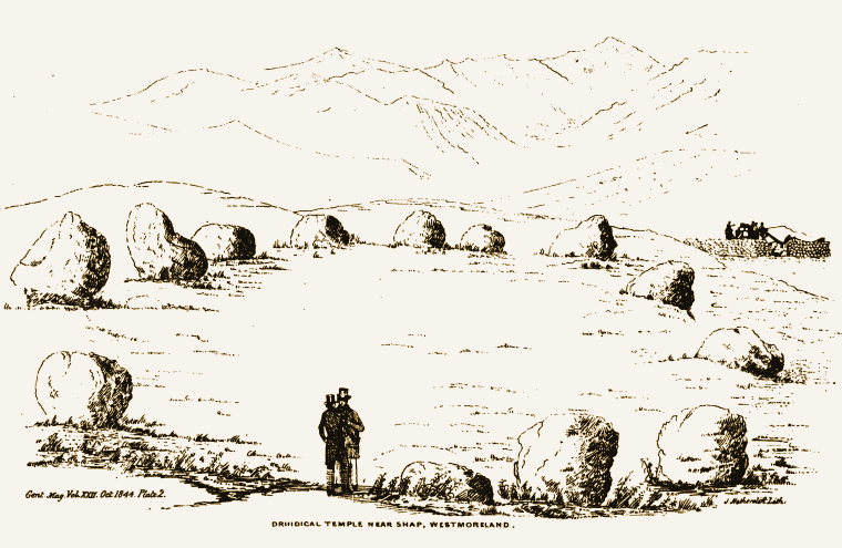
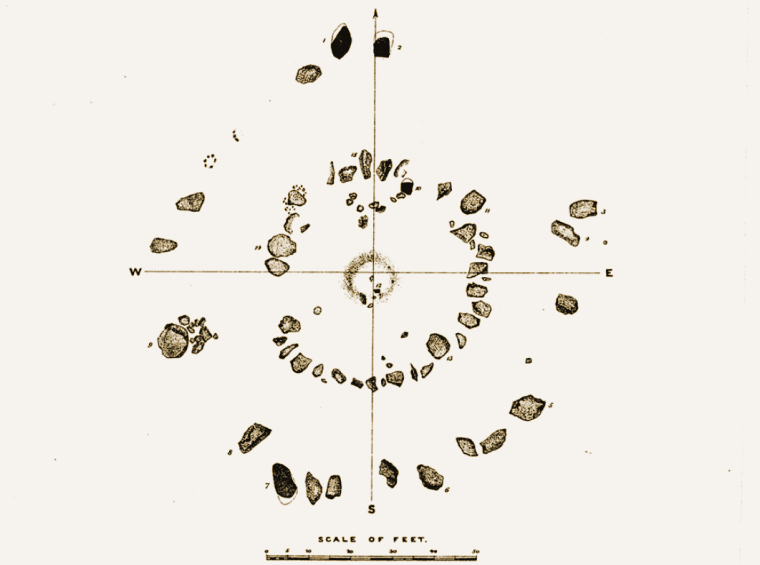
Wilson Scar, about a mile to the west of Gunnerkeld, consisted of around thirty-five small stones that stood in a 18 metre wide circle west of the A6 and north-northwest of the village of Shap itself. However the land that it stood on was part of Shap Quarry and sadly the circle stood in the way of an expansion of the site but at least a hastily conducted survey of the circle took place in 1952 prior to its destruction.
The circles form part of a much lager complex of monuments that form a roughly southeast-northwest alignment that is now shadowed by the routes of the M6, the A6 and the West Coast Mainline. See also Shap Stone Row
Probable Date: Bronze Age
Kemp Howe (photographs on this page) is the most accessible of the three circles but is badly damaged by having been bisected by the Preston-Carlisle mainline railway with only six large stones still in situ. It may originally have been around metres in diameter had not 19th century railway technology so rudely disturbed it.
Gunnerkeld, about 3 miles to the north of Kemp Howe, consists of two concentric circles, the outer circle has a couple of stones standing of the eighteen remaining and measures approximately 30 metre across. The inner circle is much better preserved with around thirty stones remaining measuring 15 metres in diameter and containing a burial mound and damaged cist. It stands on private land and permission must be sought before visiting it (unfortunately there was nobody home when I visited so I have yet to see the circle at first hand although it can be seen from the southbound carriage of the nearby M6 motorway)
Wilson Scar, about a mile to the west of Gunnerkeld, consisted of around thirty-five small stones that stood in a 18 metre wide circle west of the A6 and north-northwest of the village of Shap itself. However the land that it stood on was part of Shap Quarry and sadly the circle stood in the way of an expansion of the site but at least a hastily conducted survey of the circle took place in 1952 prior to its destruction.
The circles form part of a much lager complex of monuments that form a roughly southeast-northwest alignment that is now shadowed by the routes of the M6, the A6 and the West Coast Mainline. See also Shap Stone Row
Probable Date: Bronze Age

Looking southwest across Kemp Howe towards the hills of the Shap Fells.

Kemp Howe looking southeast. Compare this with the idyllic Cumbrian views above.
Kemp Howe/Shapsey circle, Gunnerkeld and Wilson Scar. Click thumbnails to see enlarged images.