|
Google Streetview tour of Stonehenge (may take a while to load). Use
the mouse to spin the view and to look up and down. Clicking on the
arrows will move the viewpoint to another location allowing the user
to wander amongst the stones, something that is not normally possible
at the site itself. A small icon in the top right of the view zooms
the tour to fullscreen, pressing the Escape key will return it to
normal view. Any links within the tour are external to this website
and not associated with stone-circles.org.uk in any way (i.e. they're
built into Streetview). |
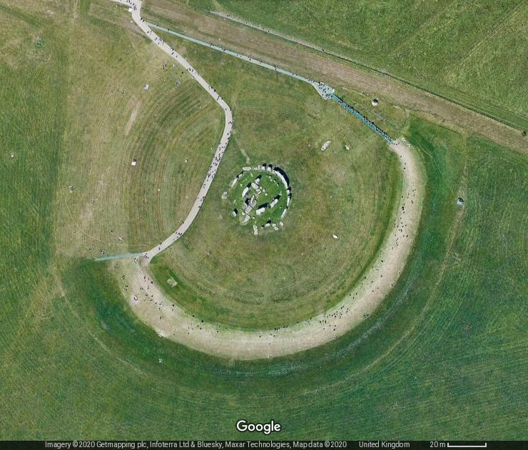 Satellite view
of Stonehenge clearly showing the remaining bank, Station Stones, the fallen Slaughter Stone and Heel Stone. Satellite view
of Stonehenge clearly showing the remaining bank, Station Stones, the fallen Slaughter Stone and Heel Stone.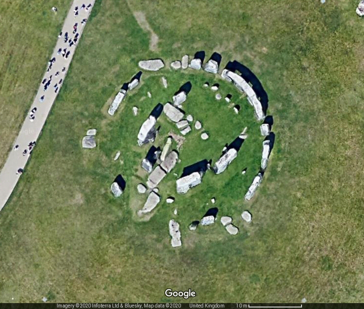 Another Satellite image showing a closer view of the main stone setting. |
Stonehenge Page 1 (main information page) Stonehenge 3D Reconstruction
Back to Map | Home | Full Glossary | Links | Email: chriscollyer@stone-circles.org.uk