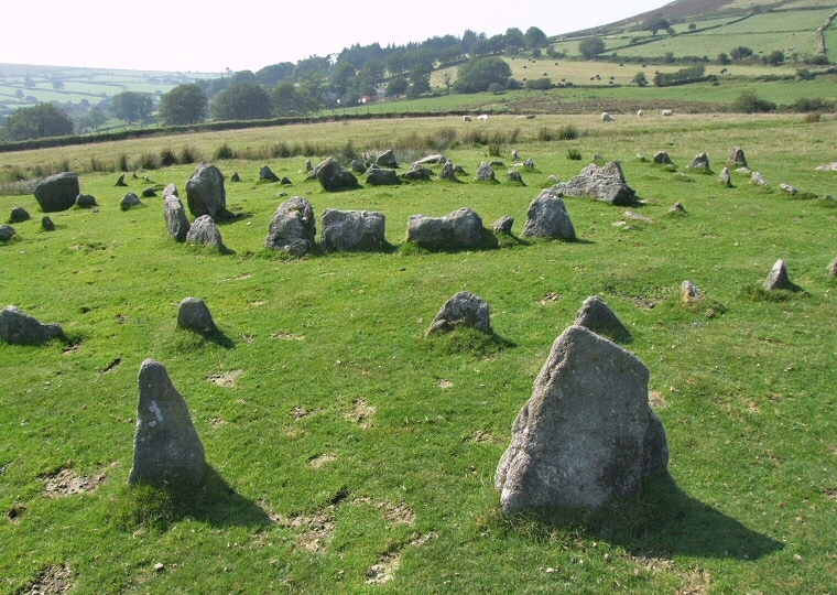
 View looking west over the concentric circles of Yellowmead. |
 Yellowmead
cairn circle is an unusual and strikingly beautiful collection of stones
situated towards the western edge of a small plateau of land between
Yellowmead Down and Ditsworthy Warren. What at first sight appears to
be a random jumble of granite boulders on closer inspection reveals
itself to be circles within circles and traces of a stone row or avenue. Yellowmead
cairn circle is an unusual and strikingly beautiful collection of stones
situated towards the western edge of a small plateau of land between
Yellowmead Down and Ditsworthy Warren. What at first sight appears to
be a random jumble of granite boulders on closer inspection reveals
itself to be circles within circles and traces of a stone row or avenue.
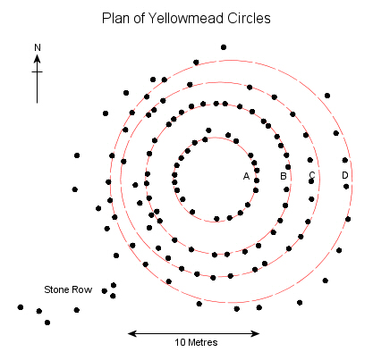
The centre of the monument is a low cairn about 4 metres in diameter which is surrounded by the close-set kerb of mostly rectangular slabs of the inner circle (marked as 'A' on the plan opposite). This circle consists of twenty-two stones up to nearly a metre in height and measures 6.7 metres in diameter. The second ring ('B') is comprised of much smaller stones most being less than a quarter of a metre tall and this time thirty-two stones form a slight oval of between 11-12 metres. Author Aubrey Burl speculates that there may have originally been as many as forty-two stones in this setting. The third ring out from the centre ('C') is similarly made up of low stones although several towards the south are a little larger with twenty-seven set into an oval of between 14-15 metres and again Burl suggests an original number of forty-two stones. The fourth ring ('D') has a diameter of between 19-20 metres with twenty-four stones remaining but with an obvious gap towards the northeast where some have been removed to build a fieldwall, Burl's estimate is that about thirty-seven stones once stood in this ring. Ring 'D' contains the largest stones at Yellowmead with those towards the southeast measuring over a metre in height. To the west of the four rings there are seven or eight further stones that form a rough arc and it could be that these are the remnants of a fifth circle that has now been all but destroyed. Leading up to the southwestern edge of Yellowmead is a small collection of low stones that appear to form part of a stone row or avenue (see picture at the bottom of this page) but the land to the west of here is enclosed pasture and it could be that most of the stones from this row have been cleared away or perhaps used for walling. The reasons for the building of such a complex monument are rather unclear, it seems that the central cairn with its kerb of stones formed the first stage of the site which was perhaps covered in earth or rubble with further rings added at a later date to extend the monument, but why, and what part the avenue played, is a mystery. The site was only discovered in 1921 by Mr. Richard Worth at which time only three stones were standing and what we see it today is thanks to the restoration work carried out shortly afterwards under the auspices of Rev. Breton (both men also worked on the stone circle at Brisworthy). More recent investigations in 2008 involved geophysical surveying of the site the results of which would seem to indicate that the pair of early 20th century antiquarians had fairly faithfully re-erected the circles to something approximating their original form. Probable Date: Bronze Age |
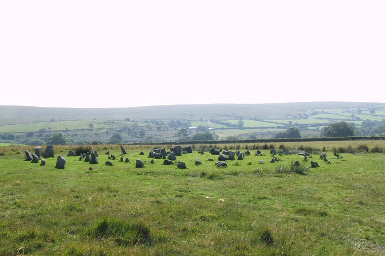 Overview of the multiple circles looking southwest through the gap in the outer ring. |
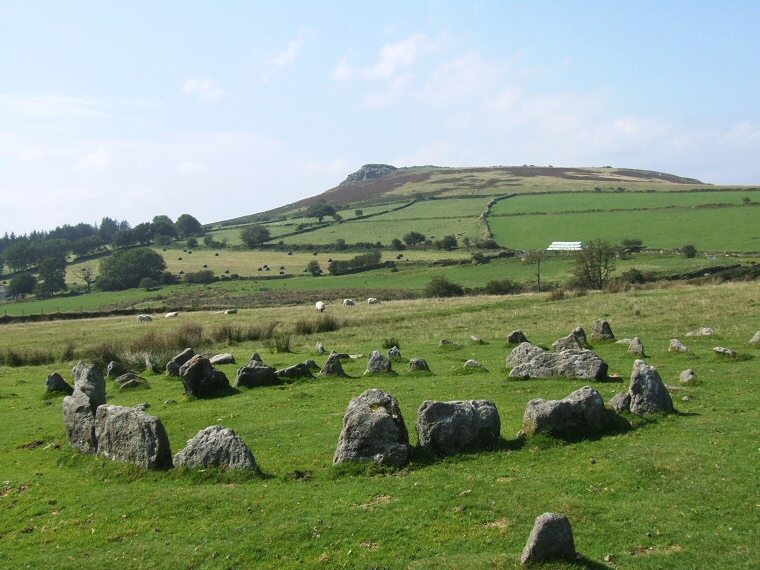 The central cairn circle of the Yellowmead looking northwest towards the hill of Sheeps Tor. |
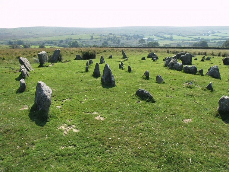 View across the four rings looking southwest over Sheepstor Brook towards Ringmoor Down. |
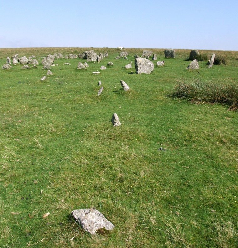 Remains of the small stone row that leads from the southwest to Yellowmead circle. |
Back to Map | Home | Full Glossary | Links | Email: chriscollyer@stone-circles.org.uk
