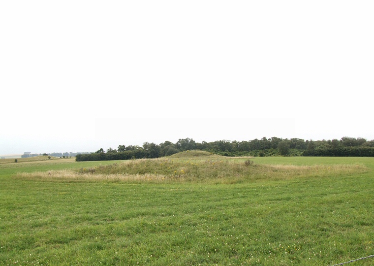
 Looking south over Amesbury 14 in the foreground with Amesbury 15 behind against the treeline of Normanton Gorse and the Bush Barrow to the left of picture. Looking south over Amesbury 14 in the foreground with Amesbury 15 behind against the treeline of Normanton Gorse and the Bush Barrow to the left of picture. |
Amesbury 14 is a somewhat damaged Neolithic long barrow oriented south-southeast to north-northwest that was first recorded as measuring over 30 metres in length but due to the action of burrowing animals and damage by the army during the First World War the visible remains are now a more modest 16 metres long, 4 metres wide and stand to a height of about 1.6 metres. It is flanked by a pair of silted side ditches up to 8 metres wide. The barrow was excavated by Sir Richard Colt Hoare and William Cunnington in 1808 and although they failed to find any human remains further digging by John Thurnam in 1856 and 1866 uncovered the disarticulated bones of three individuals that he considered to be the primary burials. Two of these showed evidence of having their skulls split which he believed happened after death but before burial which may suggest that the bodies had been left to decay elsewhere before the bones were interred in the barrow. It is even possible that this de-fleshing or cleansing of the bones could have happened nearby at the mortuary enclosure located about 750 metres to the south on Normanton Down. Thurnam also discovered two crouched inhumations which he interpreted as secondary deposits of possible Bronze Age date along with an ox shinbone and somewhat strangely, the complete skeleton of a goose. Just over 100 metres to the south of Amesbury 14 stands the later Amesbury 15, also known as the Sun Barrow as it lays on, or close to, the Stonehenge solstice axis. This nicely preserved bell barrow that dates from the Bronze Age stands 4.3 metres high, about 30 metres in diameter and has an 8 metre wide encircling ditch. It was also excavated by Colt Hoare and Cunnington who found it contained a single burial that they interpreted as an adult male, the body having been laid on an elm plank with a crushed pottery vessel though to be a beaker by its feet and accompanied by a fine bronze dagger in a wooden sheath, another smaller dagger or lance head as well as deer antlers placed towards the head and feet of the skeleton. Traces of three oak posts were also found that had extended from around the burial up to at least, and probably beyond, the top of the barrow mound. Although they may have had some practical purpose they may simply have been added as a visual embellishment to the barrow. Both barrows stand a short distance to the northwest of the main concentration of barrows on Normanton Down and also somewhat to the north of the axis that many of those barrows form along the line of the ridge that overlooks Stonehenge, instead they stand at the head of a shallow valley that leads eastwards down into Stonehenge Bottom (see map on the Normanton Down page for their relationship to the rest of the barrow cemetery). |
Site Visits / Photographs: July 2011. References: Burl, A. 1989. The Stonehenge People. London: Barrie & Jenkins Ltd. Colt Hoare, R. 1812. The Ancient History of South Wiltshire. London: William Miller. Cunnington, M. 1914. List of the Long Barrows of Wiltshire. Wiltshire Archaeological & Natural History Magazine, 38, 382. Goddard, E. 1914. List of Prehistoric, Roman and Pagan Saxon Antiquities in the County of Wiltshire. Ibid., 166. Lawson, A. 2007. Chalkland: an archaeology of Stonehenge and its region. Salisbury: The Hobnob Press. Amesbury 14: Colt Hoare Number Amesbury 165, Pastscape 219693, NMR Number SU 14 SW 91. Amesbury 15: Colt Hoare Number Amesbury 164, Pastscape 219732, NMR Number SU 14 SW 104. |