 |
|
There is very little
to be seen on the ground at this site which is the ruined remains of a Bronze Age ring
cairn. It measures between 23 and 27 metres externally with the bank extending
inwards for up to 2.5 metres and never exceeding 30 cm in height, but unlike the
site at Ewden Beck 2km to the north there are no stones
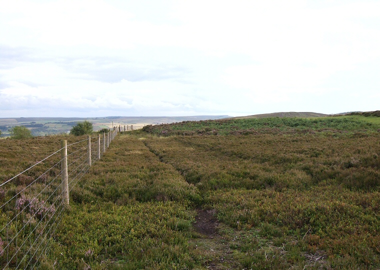
set into the bank, either standing or fallen.. The only way to really make out the form of the monument is to follow the lines caused by changes in vegetation - bilberry seems to be growing on the bank while the interior is covered in heather. In the photograph above of the site looking south, the bank would appear to be the area from the bottom of the picture up to the first fence post curving away to the mid-right. It then returns from just above, back round to the left following the darker line of vegetation Bar Dyke Ring stands on a gentle southeast slope close to a natural dip between Broomhead Moor and Canyards Hills - a minor road now passes through this gap but a milestone marked 1753 and the Bar Dyke earthwork nearby demonstrates this route has been in use for a long time, possibly even back into prehistory. A small cairnfield stands to the west along with the remains of a large cairn known as the 'Apronful of Stones' |
Back to Map | Home | Full Glossary | Links | Email: chriscollyer@stone-circles.org.uk