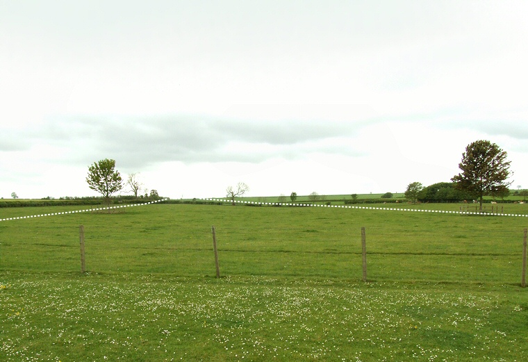
View of the course of Cursus B looking southwest from Rudston House.
It follows a west-southwest to east-northeast route starting on a hillside near Kilham Grange at grid reference TA080670 from where its elevation falls quite rapidly for the first 300 metres before steadying to loose no more than about 10 metres of height over the last kilometre of its known length as it heads towards Rudston village.
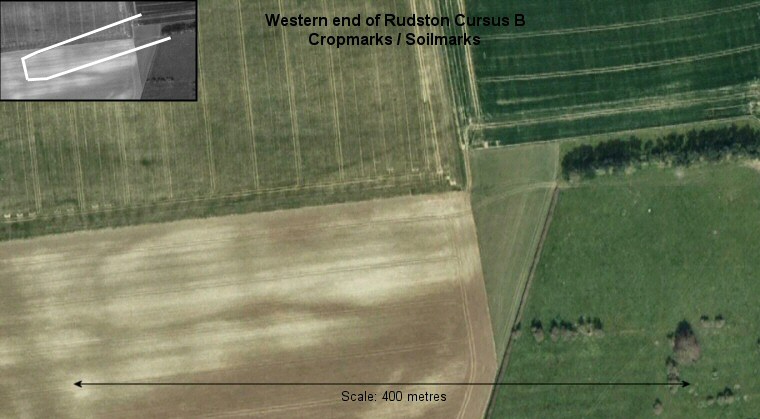
The first 600 metres of the cursus is known from crop and soil marks (see satellite image below) which then disappear for the next half a kilometre although the presumed southern edge would have closely followed the course of a modern field boundary and could lie beneath it. Another short 200 metres section has been observed from aerial photographs in a field just to the west of Rudston, the photograph above shows this field and was taken from behind Rudston House, roughly half way between the edges of the cursus at grid reference TA093674 looking towards the southwest. The actual banks and ditches are not evident at ground level (there does seem to be however a slight dip in the middle of the field that doesn't show up on the photograph) and I've marked their course with dashed lines, the distance between them is about 80 metres at this point.
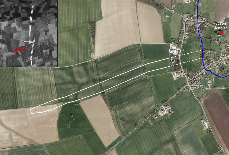
From here the rest of the cursus and the location of its eastern terminal are unknown as it probably now lies under the village and it is possible that it will remain undiscovered. It is clear that it was aligned on the same spur of land where the Rudston Monolith was later erected and as the other three cursuses all cross the Gypsey Race stream at some point it might be reasonable to assume that Cursus B also did, possibly terminating on the hillside to the south of the modern church.
The diagram at the bottom of the Rudston Introduction and Maps page shows the relationship between the four Neolithic cursus in the Rudston area.
 Bing satellite image overlaid with the course of Rudston Cursus B, also showing the Gypsey Race stream as it passes through Rudston, also shown is the location of the Rudston Monolith. The solid line represents the known extent of the cursus, the dotted line is my conjecture that it would continue to at least the edge of the Gypsey Race and probably a short distance beyond it. The inset image shows the relationship between Cursus B highlighted in red and the other three cursuses in the Rudston landscape.
Google Earth image from winter 2005 showing the faint soil and cropmarks of the western end of the cursus (shown highlighted in inset image).

Elevation profile of cursus B - data taken from Memory Map software. Starting from the western end the land falls quite rapidly loosing 17 metres of height in a distance of 350 metres before the slope becomes much more gentle with the final 300 metres being almost on the level.