Rudston Landscape Map
Showing the distribution of sites around the Great Wold Valley
and along the course of the Gypsey Race stream
Showing the distribution of sites around the Great Wold Valley
and along the course of the Gypsey Race stream
|
|
 |
The Gypsey Race is a 'winterbourne' or
intermittent stream that flows through the chalk
landscape of the Great Wold Valley area of East and
North Yorkshire. The stream's erratic behaviour flowing
both above and below ground, suddenly changing direction
as well as disappearing and then reappearing in some
years has been a source of local wonder and legend for
many years, perhaps even back into prehistory.
Evidence for the possible importance of the Gypsey Race to the prehistoric population of the Wolds can be gathered from the number of monuments that either follow the course of the stream or are clustered on the higher grounds on either side of its shallow valley. These include two of the largest round barrows in the area that are unusual in being built during the Neolithic instead of the later Bronze Age when this type of mound is usually encountered although there are several of these later barrows as well as a few more normal Neolithic long barrows within the Gypsey Race landscape. Other indicators of the importance of the stream can be deduced from the position of a now destroyed henge to the southeast of Burton Fleming that was built less than 200 metres to the east of its waters.
A important part of the landscape and the monument that the area is best known for is the tallest prehistoric standing stone in Britain, the 8 metre monolith that stands in what is now a churchyard in the village of Rudston. This spot is close to a dramatic bend in the Gypsey Race which seems to have been the focal point of much activity as uniquely there are four Neolithic cursus monuments that seem to be focused on, or around, this kink in stream.
Evidence of occupation continues in later prehistory with the Bronze Age Argham Dyke earthwork and massive Dane's Dyke near the coast northeast of Bridlington as well as Iron Age burials, settlement remains and field systems. Even the Romans seemed to have liked this area as a villa was built just to the southwest to Rudston as well the important trade route of Woldgate Roman road that ran from York to Bridlington, parts of which now lie beneath the modern road to the south of the village.
If we backtrack in time more than 10000 years from the present we find what is possibly the most tantalizing and archaeologically important site in this remarkable landscape, the Mesolithic hunting camp and ritual site of Star Carr which lies in a featureless field due south of Scarborough and due west of Filey. This waterlogged field once stood on the shores of the now vanished Lake Pickering and excavations have revealed much vital information about the earliest settlers of the Wolds area.
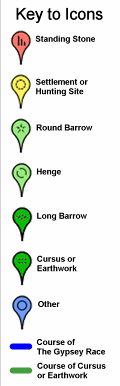
Use the map above to navigate and zoom into the landscape of the Great Wold Valley and the Gypsey Race and click on the markers for links to information pages of the various sites, alternatively the pages can be accessed directly from the links below.
Barrows:
Argham - Iron Age Square Barrow Cemetery - North of Rudston (to be added)
Butt Hills - Bronze Age Round Barrows - Wold Newton
Duggleby Howe - Neolithic Round Barrow - West of Kirby Grindalythe
Folkton - Bronze Age Round Barrow - South of Folkton
Ganton Wold - Bronze Age Round Barrows - South of Ganton
Kilham - Neolithic Long Barrow - North of Kilham (to be added)
Rudston Beacon - Bronze Age Round Barrows - South of Rudston
Sharpe Howe - Bronze Age Round Barrow - South of Folkton
Southside Mount - Neolithic / Bronze Age Round Barrows - South of Rudston
Willerby Wold - Neolithic Long Barrow and Bronze Age Round Barrows - Willerby Wold
Willie Howe - Neolithic Round Barrow - West of Burton Fleming
Wold Newton - Neolithic Round Barrow - Wold Newton
Cursuses:
Cursus A (Beacon Cursus) - Neolithic Cursus - East of Rudston
Cursus B (Breeze Farm Cursus) - Neolithic Cursus - West of Rudston
Cursus C (Glebe Farm Cursus) - Neolithic Cursus - North of Rudston
Cursus D (Argham Cursus) - Neolithic Cursus - North of Rudston
Earthworks:
Argham Dykes - Bronze Age Earthwork - Northeast of Rudston (to be added)
Dane's Dyke - Bronze Age Bank and Ditch
Henges:
Little Argham - Neolithic Henge - Southeast of Burton Fleming
Settlement Sites:
Star Carr - Mesolithic Settlement Site - South of Scarborough
Standing Stones:
Rudston Monolith - Neolithic/Bronze Age Standing Stone - Rudston
Evidence for the possible importance of the Gypsey Race to the prehistoric population of the Wolds can be gathered from the number of monuments that either follow the course of the stream or are clustered on the higher grounds on either side of its shallow valley. These include two of the largest round barrows in the area that are unusual in being built during the Neolithic instead of the later Bronze Age when this type of mound is usually encountered although there are several of these later barrows as well as a few more normal Neolithic long barrows within the Gypsey Race landscape. Other indicators of the importance of the stream can be deduced from the position of a now destroyed henge to the southeast of Burton Fleming that was built less than 200 metres to the east of its waters.
A important part of the landscape and the monument that the area is best known for is the tallest prehistoric standing stone in Britain, the 8 metre monolith that stands in what is now a churchyard in the village of Rudston. This spot is close to a dramatic bend in the Gypsey Race which seems to have been the focal point of much activity as uniquely there are four Neolithic cursus monuments that seem to be focused on, or around, this kink in stream.
Evidence of occupation continues in later prehistory with the Bronze Age Argham Dyke earthwork and massive Dane's Dyke near the coast northeast of Bridlington as well as Iron Age burials, settlement remains and field systems. Even the Romans seemed to have liked this area as a villa was built just to the southwest to Rudston as well the important trade route of Woldgate Roman road that ran from York to Bridlington, parts of which now lie beneath the modern road to the south of the village.
If we backtrack in time more than 10000 years from the present we find what is possibly the most tantalizing and archaeologically important site in this remarkable landscape, the Mesolithic hunting camp and ritual site of Star Carr which lies in a featureless field due south of Scarborough and due west of Filey. This waterlogged field once stood on the shores of the now vanished Lake Pickering and excavations have revealed much vital information about the earliest settlers of the Wolds area.
Use the map above to navigate and zoom into the landscape of the Great Wold Valley and the Gypsey Race and click on the markers for links to information pages of the various sites, alternatively the pages can be accessed directly from the links below.
Barrows:
Argham - Iron Age Square Barrow Cemetery - North of Rudston (to be added)
Butt Hills - Bronze Age Round Barrows - Wold Newton
Duggleby Howe - Neolithic Round Barrow - West of Kirby Grindalythe
Folkton - Bronze Age Round Barrow - South of Folkton
Ganton Wold - Bronze Age Round Barrows - South of Ganton
Kilham - Neolithic Long Barrow - North of Kilham (to be added)
Rudston Beacon - Bronze Age Round Barrows - South of Rudston
Sharpe Howe - Bronze Age Round Barrow - South of Folkton
Southside Mount - Neolithic / Bronze Age Round Barrows - South of Rudston
Willerby Wold - Neolithic Long Barrow and Bronze Age Round Barrows - Willerby Wold
Willie Howe - Neolithic Round Barrow - West of Burton Fleming
Wold Newton - Neolithic Round Barrow - Wold Newton
Cursuses:
Cursus A (Beacon Cursus) - Neolithic Cursus - East of Rudston
Cursus B (Breeze Farm Cursus) - Neolithic Cursus - West of Rudston
Cursus C (Glebe Farm Cursus) - Neolithic Cursus - North of Rudston
Cursus D (Argham Cursus) - Neolithic Cursus - North of Rudston
Earthworks:
Argham Dykes - Bronze Age Earthwork - Northeast of Rudston (to be added)
Dane's Dyke - Bronze Age Bank and Ditch
Henges:
Little Argham - Neolithic Henge - Southeast of Burton Fleming
Settlement Sites:
Star Carr - Mesolithic Settlement Site - South of Scarborough
Standing Stones:
Rudston Monolith - Neolithic/Bronze Age Standing Stone - Rudston

Simplified map of the inner Rudston area showing the courses of the four cursus monuments as well as the Rudston Monolith, Little Argham Henge, Southside Mount Neolithic Barrow and Beacon Hill Bronze Age Barrows.