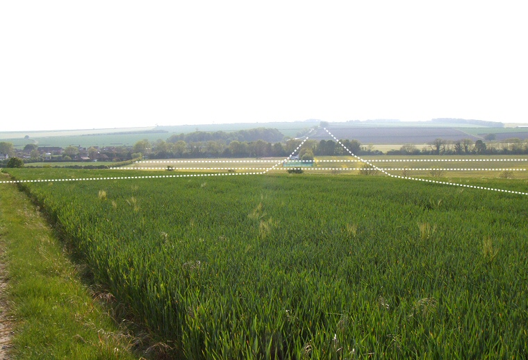
View looking west over the junction of two cursuses north of Rudston in early evening sunlight.
Cursus C starts close to the B1253 road on the hill in the distance then travels eastwards down the gentle slope of the hillside that leads into Rudston before crossing the Gypsey Race stream a short distance to the north of the modern village which can be seen to the left of the image. From here the cursus climbs up the much steeper hillside to the east of the valley where it is thought to end either beneath the trees of Bridlington Gate Plantation just behind the camera or to carry on a very short distance to where it would have met the northern section of Cursus A (the Beacon Cursus). It is possible that it actually ends beneath Cursus A in which case this would indicate that Cursus C predates Cursus A.
Like many cursuses these two only survive as cropmarks seen from the air and sometimes visible from the ground at certain times of the year depending on what, if anything, is growing in the fields. In these pictures I've calculated their positions from the detailed maps contained in 'Ancient Landscapes of the Yorkshire Wolds' by Catherine Stoertz and published by the Royal Commission on the Historical Monuments of England.
The diagram on the Rudston Introduction and Maps page shows the relationship between the four Neolithic cursus monuments clustered around Rudston village.

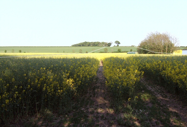
Photograph looking eastwards and uphill towards Bridlington Gate Plantation taken from close to the northern bank of Cursus C, marked with a dashed line. The southern bank, also marked, passes through part of the recreation area to the right of the image.
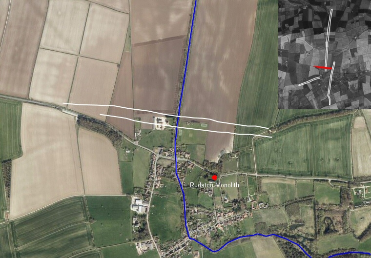
 Bing satellite image overlaid with the known extent of Rudston Cursus C shown as solid white lines. Also shown is the course of the Gypsey Race stream and the position of the Rudston Monolith. A pair of dark lines in the field directly below the eastern end of the cursus are the cropmarks of part of Cursus A. The inset image shows the relationship between Cursus C highlighted in red and the other three cursuses in the Rudston landscape.
This elevation profile of Cursus C prepared with data from Memory Map software clearly shows the three distinct divisions of the course of the earthwork, gently sloping down from the west before a flat run across the Great Wold Valley and the Gypsey Race stream before a short steep climb to end upon the hillside of Bridlington Gate Plantation. At less than a mile long Cursus C is the shortest of the four cursuses clustered around Rudston.