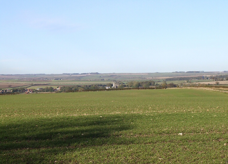
View north toward the village of Rudston from the southern terminal bank of the cursus which can be seen as a slightly raised area running left to right in front of the line of chalk rubble and under shadow.
One
of the major components of the prehistoric Great Wold Valley and the Gypsey Race landscape must have been Cursus A also known as the Beacon Cursus.
However it is not alone, there are four of these Neolithic earthwork monuments in this area and two of these, Cursus B and Cursus D are both almost, but not quite, aligned on the monolith in the village - the tallest standing stone in Britain while both Cursus C and Cursus A both pass close by the huge stone. It has also been noticed that Cursus D follows the course of the Gypsey Race for around half of its 4 km length, and both it and Cursus A and C cross over the stream at some point in its course. Cursus B may also have done so but its eastern end is thought to lie beneath the modern village and so cannot be located.
Traces of Cursus A can be seen from a distance when looking south from the B1253 road just east of Rudston from where it appears as a faint double cropmark crossing a field at around TA099667. Further south in a corner of a field at TA099658 close to the junction of the Roman Woldgate and the road that runs into Rudston the southern end of the cursus survives as a slightly raised bank, although it tends to disappear under farm crops during the summer. This bank was partially excavated in 1869 by Canon Greenwell who though it may have been a barrow, it is interesting to note that he found the remains of six bodies within this bank.
It is not fully understood what the purpose of a cursus was, 18th century antiquarian William Stukeley thought they may have been prehistoric racecourses hence the Latin name, although It seems much more likely that they were some kind of processional walkways, designed to lead people through ritual landscapes.
See also: Introduction and maps of the Rudston Landscape
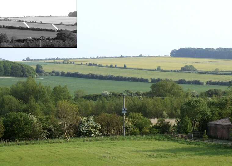
Traces of Cursus A can be seen as a pair of cropmarks crossing the field near the top of the picture (see inset).
The photo was taken from beside the B1253 looking south towards Rudston Beacon on the horizon.
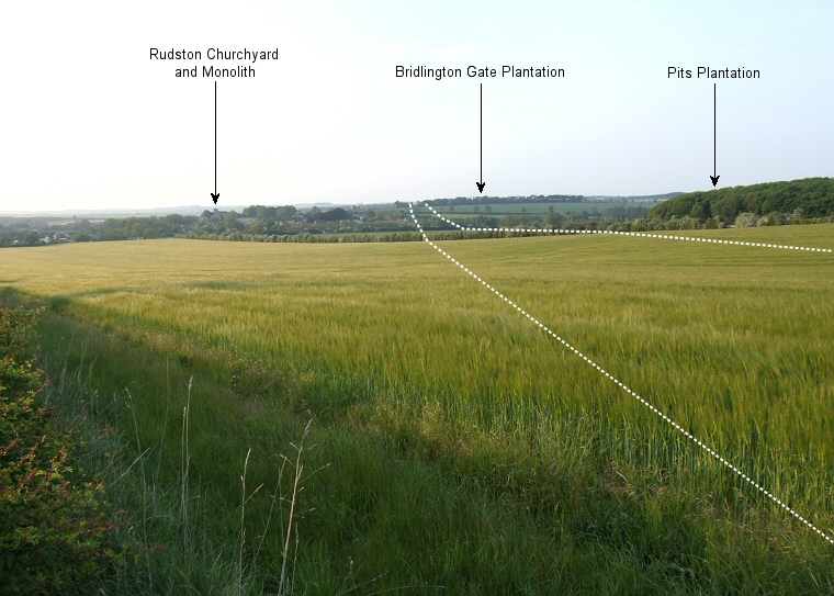
Photograph taken from Burton Agnes Balk looking northwards towards Bridlington Gate Plantation. The dashed line shows the course of the cursus as it travels downhill into the Great Wold Valley and crosses the Gypsey Race stream before rising uphill to end about 300 metres to the north of the plantation.
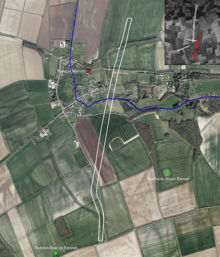 Bing satellite image overlaid with the course of Rudston Cursus A, also showing the Gypsey Race stream as it passes through Rudston. Also marked are the Rudston Monolith, the site of round barrows at Rudston Beacon and the Neolithic barrow of Southside Mount. The inset image shows the relationship between Cursus A highlighted in red and the other three cursuses in the Rudston landscape.
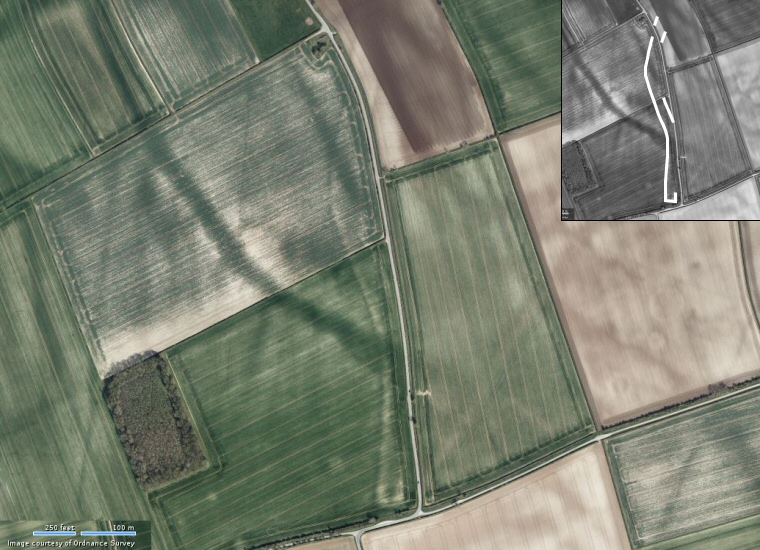 Bing satellite view of the
cropmarks at the southern end of Cursus A (highlightend on the inset image). They starts just to the left of the road of Burton
Agnes Balk which runs
north-south through the centre of the picture then continue
northwards where they kinks to the left before veering right and crossing
the road before being lost from view.
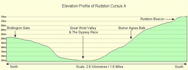
Elevation profile of Cursus A with north to the left and south to the right (data from Memory Map software). From the north the cursus starts on the western side of the hill where Bridlington Gate plantation lies and soon descends south-southwest into the Great Wold Valley where it passes to the east of Rudston village and crosses the Gypsey Race stream. The landscape starts to rise rapidly and the cursus travels uphill to cross a minor road at Burton Agnes Balk and suddenly takes a dogleg turn to the south-southeast before swinging round to its original direction to end on the eastern slope of Rudston Beacon.