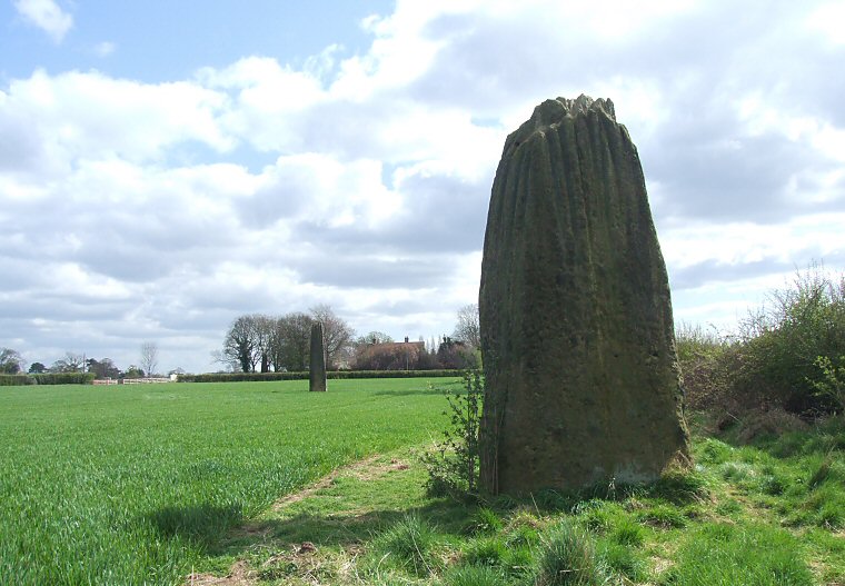
 The Devil's Arrows looking southeast. The southern stone can be seen in the trees to the left of the middle stone. |
| The Devil's Arrows
consists of three huge stones that remain from an original four or five
that stood in a southeast to northwest alignment less than 200 metres
from the modern day A1(M) motorway, however they are of course considerably
older dating from either the late Neolithic
or early Bronze
Age. The stone at the southern end of the alignment is partially hidden under trees in its own fenced enclosure on the south side of a road that leads from Boroughbridge to Roecliffe and stands nearly 7 metres tall making it the second tallest standing stone in Britain only beaten by the mighty 8 metre monolith at Rudston. It has a cross section of 1.4 by 1.2 metres and excavations in 1881 discovered it is buried a further 1.8 metres beneath the ground surface. The other two stones stand to the north of the road with the middle one located 110 metres away in a farmers field and measuring about 6.7 metres tall being 1.5 and 1.2 metes in section with a slight but noticeable lean to the south. Excavations in 1709 found a further 1.5 metres of the stone below ground level as well as cobbles and clay used as packing material and it could be subsidence of this material that has led to its present off vertical tilt. The final arrow 60 metres away at the northern end of the alignment is close to a field boundary and is a rather more squat 5.5 metres tall but what it lacks in height it makes up for in breadth compared to the other two more slender companions by having a cross section of 2.6 by 1.4 metres, its long axis being perpendicular to the alignment. Excavations here in 1876 revealed 1.4 metres of the stone was beneath ground level. It is interesting that although the Devil's Arrows form an alignment the three stones do not stand in a straight line - the middle monolith is offset slightly to the west. All three stones are made of millstone grit and are heavily weathered and fluted at their peaks with the northern and southern stones having various indentations that could be interpreted as being cup marks although these marks could either be natural or the result of deliberate damage to the stones over the years (indeed the southern stone is also carved with a modern OS benchmark). It is believed that the stones were quarried about 7 miles to the southwest from an outcrop known as Plumpton or Plompton Rocks the stones of which are said to bear similar eroded fluting to that found on the tops of the arrows. There were once a couple of other stones on the site that are now missing. One stood close to the central stone and is believed to be the one recorded as standing by the antiquary John Leland in the early part of the 16th century although 30 years later William Camden reports that it has been felled by those in search of buried treasure. The top part of this stone is said to stand in the ground of Aldborough Manor while another part of it may have been used to construct a bridge across the River Tutt. Several local gardens are also said to have boulders or stone remains that may have formed parts of one or more other missing stones. If the remaining 170 metre alignment of the Devil's Arrows were to be extended northwestwards it would lead down to a ford in a bend in the River Ure, the same river that passes close to the Cana and Hutton Moor henges about 4 miles to the northwest, the destroyed Nunwick henge 7 miles northwest and the three famous henges at Thornborough 10 miles northwest and it is impossible not to come to the conclusion that all of these monuments formed part of a huge prehistoric ritual landscape based on the valley of the River Ure. In common with other sites, the fair of St. Barnabas was held near the stones on Midsummer's Day until the 18th century while legend says that the site's name comes from an account of the Devil trying to fire arrows at the nearby Christian settlement at Aldborough from Howe Hill, the arrows falling short and landing in a line in the field. *Stone measurements from English Heritage documents. |
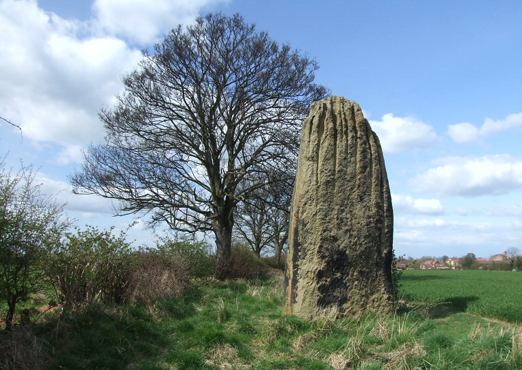 The northern stone is the shortest but broadest of the three and is heavily fluted. |
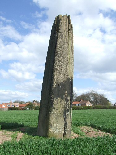 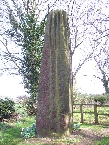 Left: The central stone with its pronounced lean. Right: The southern stone in its small enclosure. |
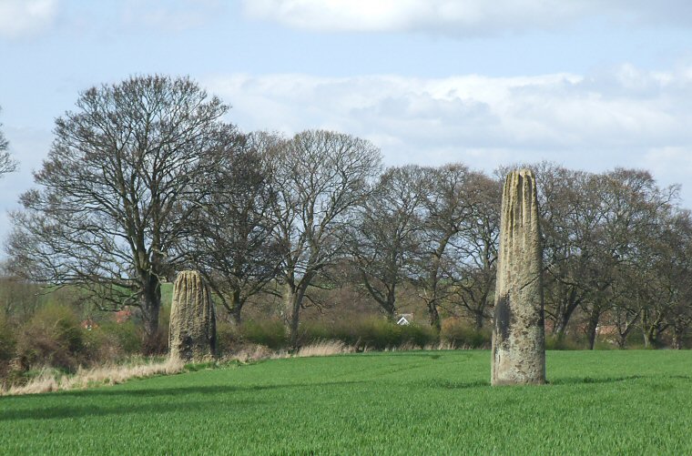 Looking north at the central and northern stones from the track that runs around the edge of the farmers field. |
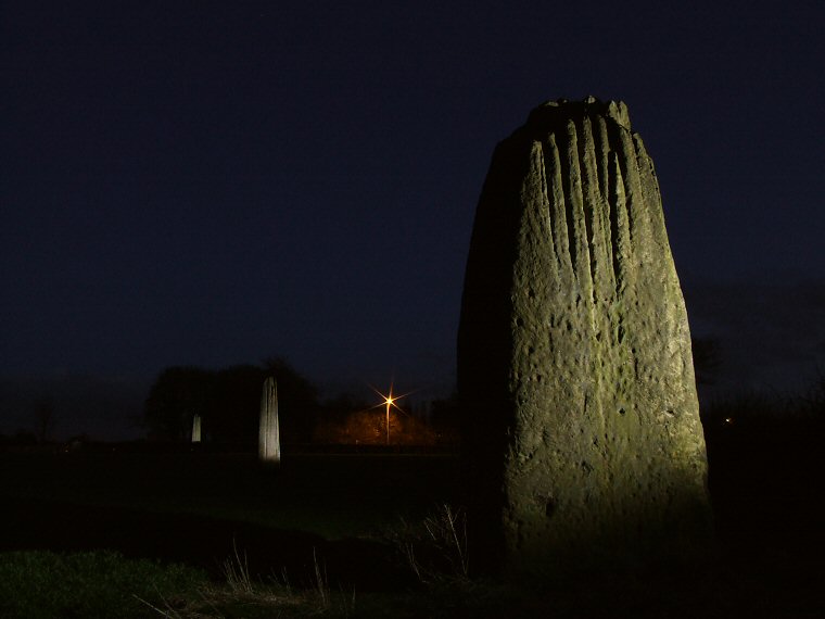 The Devil's Arrows at night lit by flash |
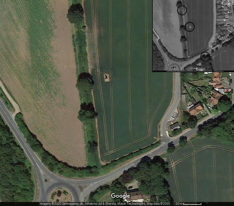 Satellite image of The Devil's Arrows. The north and central stone are in the field in the middle of the image, the southern stone is in the trees at the bottom of the picture (stones marked on inset image). |