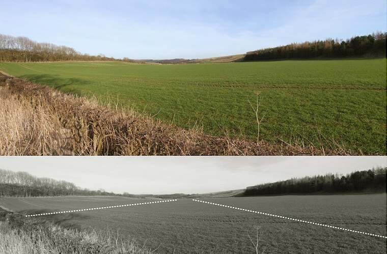
Looking east from what is assumed to be the western terminal of the cursus.
Aerial photographs
of this valley to the northeast of the village of Fimber show the crop
marks of a pair of almost parallel ditches that have been interpreted
as a Neolithic Cursus.
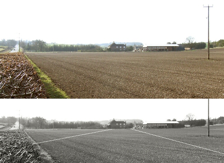
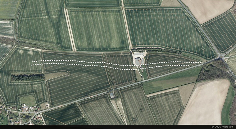
They appear to start somewhere close to a minor road that leads towards Towthorpe (shown above with a black and white plan showing their course) and extend along the west-east valley passing under the buildings of Fimber Grange and becoming untraceable as they reach the B1251 road (image below with plan). Here a modern roundabout marks the location of a natural crossroads formed by four valleys, the B1251 occupies two of these valleys, the southern section of the B1248 runs along another and the forth containing Triplescore Plantation is edged by a later prehistoric earthwork.
This glacial geology is very reminiscent of that seen at Folkton, where the famous chalk drums were found within a barrow on the hillside but although there are no records of barrows on the hills to the east of the Fimber, the crossroads between the hills seems to act as a focus for the cursus and if we suppose cursuses formed processional routeways through symbolic landscapes then it could well be that this crossroads was the destination and the cursus was processed in a west to east direction.
As is often the case there remains nothing visible at ground level of the cursus banks and ditches, the crop marks suggest that they were between 18-27 metres apart towards the west and 30-37 apart towards the east with a possible 100 metre gap in the northern ditch close to this end. The total length of the cursus is currently thought to be about 1300 metres - almost exactly the same as the Breeze Farm Cursus (Cursus B) at Rudston although as the terminals of the Fimber Cursus are yet to be discovered its true length remains unclear.

Looking west from the centre of the eastern end of the cursus.

Satellite image of the Fimber area with Fimber village bottom left and the cursus cropmarks shown as dotted lines. It is assumed that the cursus extended to somewhere near the road on the left..
Width of image approximately 1700 metres.

Elevation profile of Fimber Cursus. Although the cursus falls away from west to east the drop in altitude is only slight, being from about 84 metres to 73 metres. Compare this profile with that of the Breeze Farm Cursus at Rudston, also 1300 metres long but having a steeper gradient.
References:
Pastscape: 910856, NMR Number: SE 86 SE 35
Stoertz, C. 1997. Ancient Landscapes of the Yorkshire Wolds. Aerial photographic transcription and analysis. RCHME.
Tilley, C. 1994. A Phenomenology of Landscape. Places, Paths and Monuments. Oxford: Berg Publishers.