 |
|
This
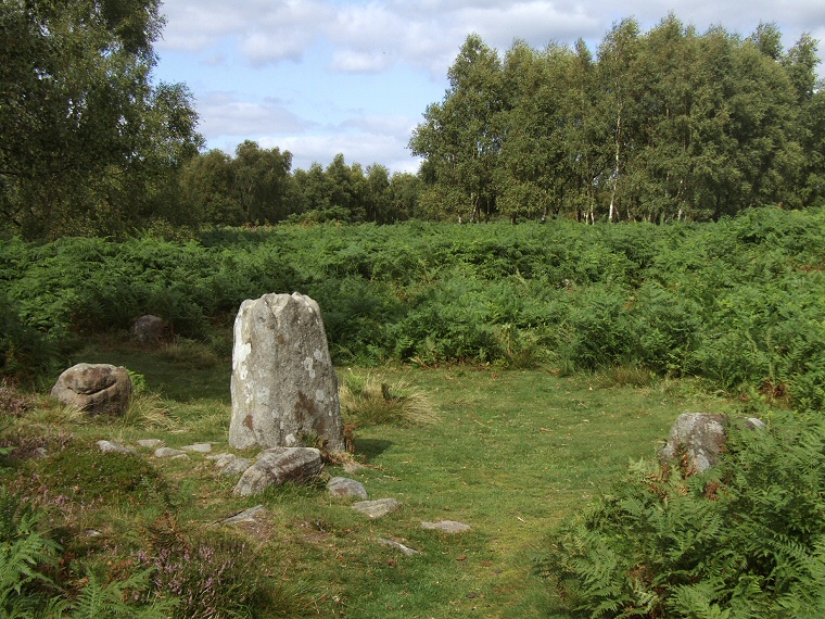
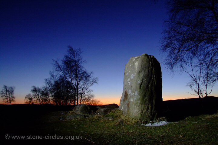
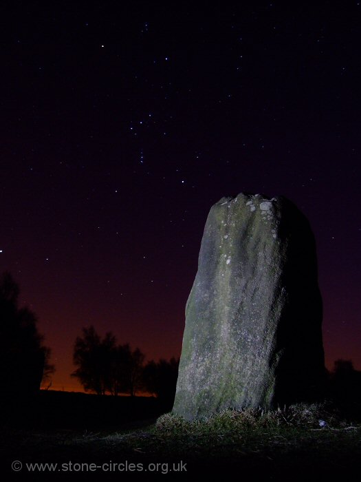
somewhat damaged embanked stone circle stands just a few metres east of Froggatt Edge, just before the rocky precipice falls away dramatically westwards down into the valley of the River Derwent. The circle is also located toward the western edge of the plateau of land known as Stoke Flat which gives the site its alternate name of Stoke Flat Circle.  The circle is of probable Bronze
Age date and
what now remains at the site are around fourteen typically small Derbyshire gritstone blocks, most about half
a metre tall with only one that reaches just over a metre in height. The
stones seem to form a double ring with seven set into the inner edge of
a low 2-3 metre wide rubble bank that barely reaches half a metre in height with a further five stones set into the outer edge
of the bank, the whole monument being about 15-16 metres in diameter. Traces of small stones laid horizontally, particularly in the northern sector, suggest that the inner edge of the bank was originally revetted by a course of drystone walling. The circle is of probable Bronze
Age date and
what now remains at the site are around fourteen typically small Derbyshire gritstone blocks, most about half
a metre tall with only one that reaches just over a metre in height. The
stones seem to form a double ring with seven set into the inner edge of
a low 2-3 metre wide rubble bank that barely reaches half a metre in height with a further five stones set into the outer edge
of the bank, the whole monument being about 15-16 metres in diameter. Traces of small stones laid horizontally, particularly in the northern sector, suggest that the inner edge of the bank was originally revetted by a course of drystone walling.Several authors suggest that there were originally sixteen to eighteen stones within the circle but it is clear from the plan left that if the missing stones occupied a regular spacing then each ring could have composed of around sixteen-eighteen stones (possible missing stones marked as small circles on the plan, standing stones marked black, fallen or leaning stones marked grey, stone numbering as used by Barnatt 1978). However four small leaning stones in the northeast sector (Stones 10,11, 14 and 15) don't quite fit the presumed plan so the original layout of the circle and the total number of stones remains unclear. The tallest stone of the circle stands at the south-southwest (Stone 3) and flanks a 2 metre wide entrance with the much shorter Stone 2 while just beyond the pair are a further two small portal stones half-way between the inner and outer rings (Stones 8 and 9). The photograph above is looking through this southern entrance with the three remaining stones of an opposing 2 metre wide entrance to the north-northeast (Stones 1, 6 and 7) framed in the middle of the picture immediately below the copse of trees. Most of the stones forming the two entrances are set radially to the circle (i.e. their longer edges follow the line of the entrances rather than following the circumference of the rings). However the northern entrance has been blocked with rubble to form a continuation of the bank, this is assumed to have been done in prehistory and may point to a change in use or re-modeling of the site for some unknown reason. There have been few finds from the circle which has never been excavated to modern standards, the only documented digging occurring sometime before 1939 carried out by the Duke of Rutland and his gamekeeper Mr E. H. Peat which is said to have recovered some cremation remains and an urn, sadly these are now lost. Peak District archaeologist and author John Barnatt has suggested several celestial alignments were incorporated into the Froggatt Edge circle. As the site is located on land that dips sharply westwards with the horizon to the east blocked by nearby higher ground and given that many of the stones are now missing from this sector anyway, then most of the alignments proposed by Barnatt are to the west and involve the setting sun over Eyam Moor on the opposite side of the River Derwent. 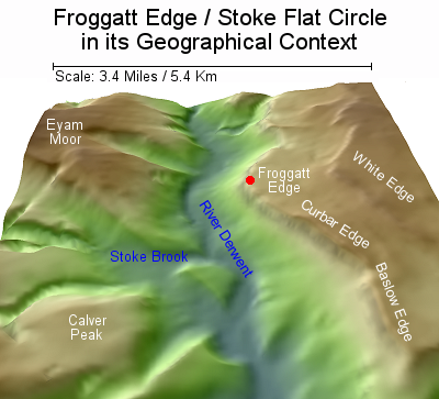 Firstly, Barnatt says the Winter Solstice sunset would have been along the right-hand edge of the tallest circle stone (Stone 3) exactly replicating the same sunset along the right-hand edge of the tallest stone at the circle of Barbrook I, 1.9 miles (3km) away to the east-southeast where the tallest stone is also located in the south-western sector of that circle. If Barnatt is correct then this may imply some kind of synchronised activity between the two sets of communities tied to Midwinter when the sun reaches its most southerly set and reverses its direction with the promise of longer, warmer days ahead. The choice of the edge rather than the top of the stone to act as a chronological marker probably comes down to accuracy, an edge offering a narrow vertical pointer as opposed to the broad flat top of the stone (alignment marked on the 360 degree panorama below). Firstly, Barnatt says the Winter Solstice sunset would have been along the right-hand edge of the tallest circle stone (Stone 3) exactly replicating the same sunset along the right-hand edge of the tallest stone at the circle of Barbrook I, 1.9 miles (3km) away to the east-southeast where the tallest stone is also located in the south-western sector of that circle. If Barnatt is correct then this may imply some kind of synchronised activity between the two sets of communities tied to Midwinter when the sun reaches its most southerly set and reverses its direction with the promise of longer, warmer days ahead. The choice of the edge rather than the top of the stone to act as a chronological marker probably comes down to accuracy, an edge offering a narrow vertical pointer as opposed to the broad flat top of the stone (alignment marked on the 360 degree panorama below).The sunset in early February and November which closely equates with the Celtic festivals of Oimec and Samhain (and the Christian Candlemas and Martinmas) would have been along the left hand edge of Stone 4 while the Equinox sunsets would have occurred close to the assumed position of the first missing stone north of Stone 4. The next sunset would also have been marked by the next missing stone north, assuming it also existed, being the set in early May (the Celtic Beltaine) and early August (the Celtic Lugnasadh and Christian Lammas) with Barnatt's final proposed sunset falling on the Summer Solstice when the sun would set between Stones 5 and 12 in the north-western sector of the circle. However the most intriguing alignment from Froggatt Edge involves not the sun but the Midsummer moon which when seen from the circle would have its maximum set between the stones of the southern entrance and directly behind (or as Barnatt puts it, 'into') the distant henge and circle of Arbor Low, 10 miles (16 km) away on Middleton Common. That this may have been a sheer coincidence seems unlikely. Although Arbor Low would already have been several hundred years old by the time the farmers on Froggatt Edge built their own circle, we can infer the continued importance of the henge as a regional ceremonial centre and it would seem probable that referencing its location in the design and orientation of the Froggatt Edge circle is likely to have been a deliberate act. It may also give us clues to the wider community that the populations on the eastern side of the River Derwent saw themselves as belonging to at this point in prehistory. The small stone circles they built were designed to serve the needs of small local communities but these farming groups were not isolated, they were part of a larger whole, they perhaps viewed themselves and other local communities as having a shared regional identity and set of belief systems. Additional Notes: The antiquarian record is rather scant regarding this circle. The ubiquitous Derbyshire barrow digger Thomas Bateman writing in 1848 gives us the following brief description 'Upon Froggat Edge, an elevated tract of land, with a precipitous front or "edge" as implied in its name, is still seen a Druidical circle, about twelve yards in diameter, formed of stones placed at regular distances, having within the circle on the south side, a large stone standing to a height of near five feet about the heath-covered earth'. Sadly he makes no mention of the number of stones still present in his day. Half a century later Ella Armitage gives a similar account of the site and although she mentions the bank she also gives no indication of how many stones remained within the circle itself - 'On Froggatt Edge, right above the Mason's Arms, on the E. side of the drive which runs along the top of the moor, there is a small circle with a low rampart, which has standing stones on each side of its bank, one of them being at least 4 feet high. It has two well marked entrances, N. and S.'. Older references to this stone circle nearly always refer to it as 'Froggatt Edge' or 'on Froggatt Edge', as above, whereas more recent sources, particularly those written by Barnatt refer to it as Stoke Flat. I'm not sure why this is as Stoke Flat covers a wide area between Froggatt Edge and the outcrop of White Edge to the east and as the circle is located within a stones throw of the cliff edge then the traditional name for the site would seem to be the most geographically accurate. |
|
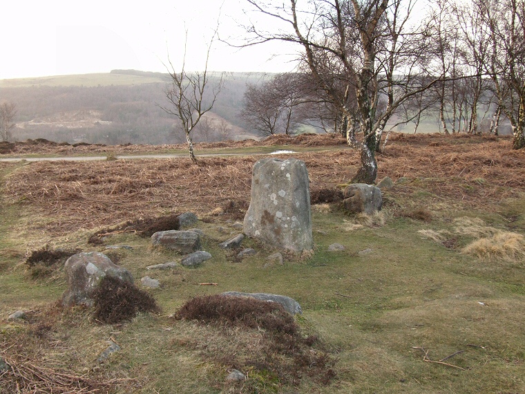
 Looking out through the northern entrance. The stone in the foreground-left is set into the inner edge of the bank with the two stones beyond set into the outer bank. The small stone foreground-right may just be a packing stone or a convenient nearby stone placed there recently. |
|
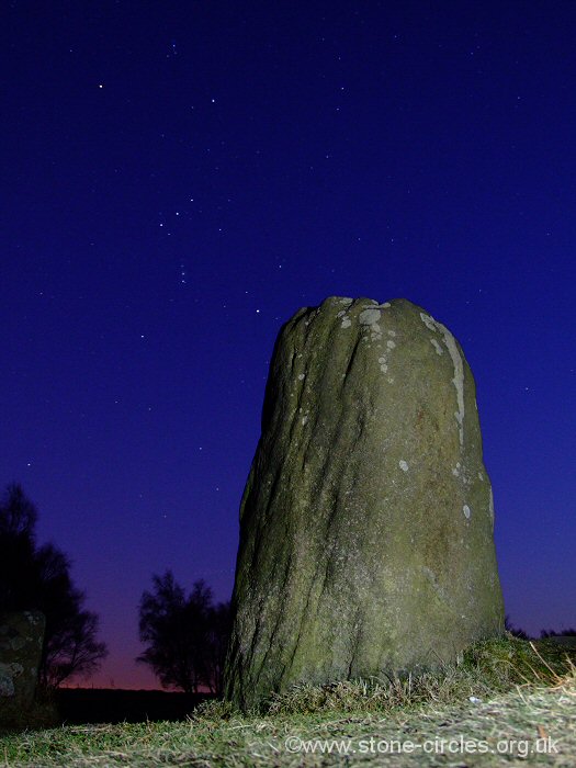
 A murky winter's day at Froggatt Edge Circle looking west across the Derwent valley. |
|
 Click thumbnails above to enlarge. |
|
Site Visits / Photographs: Winter 2000, August 2007, March 2008 (three visits), February 2010, March 2010, December 2010. References: Ainsworth, S. 2001. Prehistoric Settlement Remains on the Derbshire Gritstone Moors. D.A.J., Vol 121, 19-69. Andrew, W. 1907. Prehistoric Stone Circles of Derbyshire. In Cox, C. (ed.) Memorials of Old Derbyshire. 70-88. Armitage, E. 1897. A key to English Antiquities... Sheffield and Rotherham District. Sheffield: Townsend. Barnatt, J. 1978. Stone Circles of the Peak. London: Turnstone Books. Barnatt, J. 1987. The Design and Distribution of Stone Circles in Britain. Thesis, (PhD). University of Sheffield. Barnatt, J. 1986. Bronze Age Remains on the East Moors of the Peak District. D.A.J., Vol 106, 18-100. Barnatt, J. 2000. ...Later Prehistoric Farming Communities...in the Peak. D.A.J., Vol 120, 1-86. Barnatt, J. and Chambers, F. 1996. Recent research at Peak District Stone Circles. D.A.J., Vol 116, 27-48. Barnatt, J. and Smith, K. 2004. The Peak District: Landscapes Through Time. Macclesfield: Windgather Press. Bateman, T. 1848. Vestiges of the Antiquities of Derbyshire. London: John Russell Smith. Burl, A. 1976. The Stone Circles of the British Isles. London: Yale University Press. Burl, A. 1995. A Guide to the Stone Circles of Britain, Ireland and Brittany. London: Yale University Press. Edmunds, M. and Seaborne, T. 2001. Prehistory in the Peak. Stroud: Tempus. Jewitt, L. 1884. Half-hours among some English antiquities. New Edition. London: Allen. Morgan, V. and Morgan, P. 2001. Rock around the Peak. Wilmslow: Sigma Leisure. Historic England Research Records Hob Uid: 311905. Scheduled Monument: 29805. National Monuments Record Number: SK 27 NW 38. County Number: DR 137. |
|
