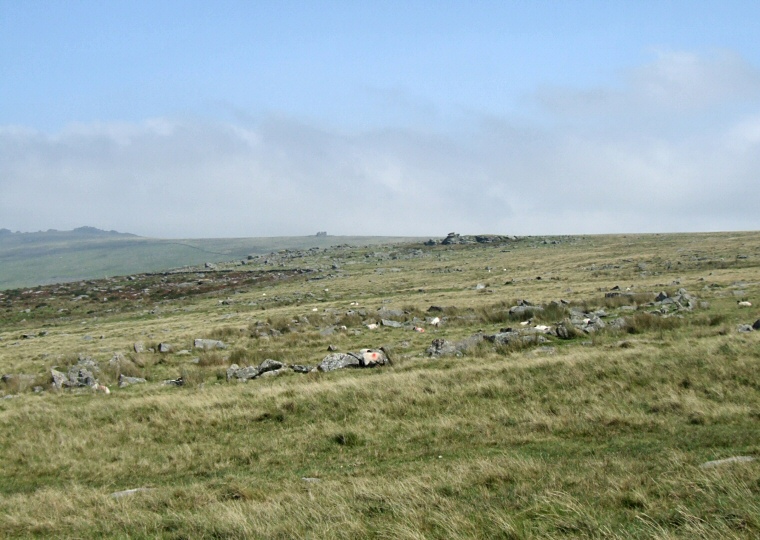
 Merrivale settlement site - view looking east over the central enclosure. |
|
The extensive
settlement site at Merrivale exists to the northeast of the famous stone
rows that cross Longash Common with huts and enclosures lying on either
side of the B3357 road as it makes its way eastwards uphill towards
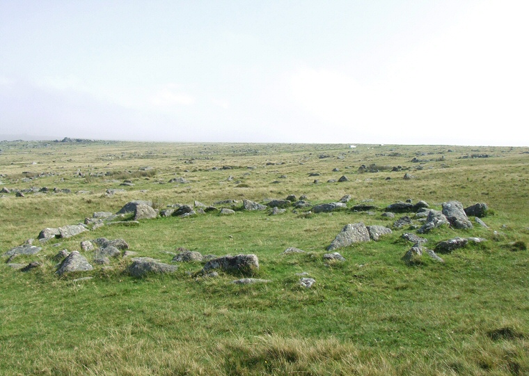
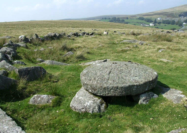
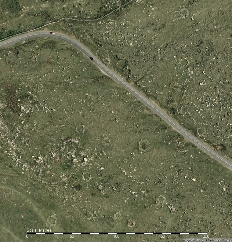
Rundlestone. The settlement consists of four enclosures and nearly forty hut remains although interestingly most of these lie outside of the enclosures perhaps suggesting that the enclosures were either the preserve of tribal leaders and hence cordoned off from the rest of the population or that the walls of the enclosures were designed to pen livestock with the internal huts being the shelter for shepherds. The most clearly defined enclosure occurs towards the centre of the settlement (photograph above) and consists of an oval of stone and rubble nearly 3 metres wide and up to a metre and a half high measuring 60 metres by 30 metres oriented northeast-southwest. There is a small gap in the wall towards the north which may have been the original entrance and a single hut stands nearby while evidence of later use of the site can be seen close to the western wall where a curious circular domed block of granite is the remains of a medieval apple crusher. Another enclosure that stands a short distance to the northwest is a similar size although not as easy to spot on the ground and contains a pair of hut remains while the enclosure to the southeast is much smaller and even more difficult to make out, a forth enclosure to the north seems to be partially overlain by the modern road. The stone bases of the huts that lie scattered about the site are evidence that Merrivale was quite a well populated area and it might be noted that the huts are in general larger than those found at places such as Sharpitor and Drizzlecombe, ranging in size from 5-10 metres in diameter. To get an impression of what these Bronze Age homes may have looked like have a look at the reconstruction of roundhouses on the Flag Fen page. It seems evident that there was a clear demarcation of the monuments at Merrivale as the settlement area stands away from and slightly upslope of the stone rows and cairns and while this might point to the two areas being in use at different times it seems more likely that they are contemporary with the separation of the areas for the living (the huts) and the areas for the dead (the cairns and rows) being a deliberate act on the part of the prehistoric inhabitants of the moor. |
 View looking northeast over one of the hut bases with the walls of the central enclosure immediately beyond and the outcrop of Great Mis Tor towards the upper left of the picture. |
 Medieval apple crusher with the central enclosure walls beyond. |
 Bing satellite image of part of the settlement site at Merrivale with many hut circles visible especially towards the top and in lines across the middle and bottom of the view. |
Back to Map | Home | Full Glossary | Links | Email: chriscollyer@stone-circles.org.uk