The Rollright
Stones consists of three sets of prehistoric monuments straddling a ridge that now forms the Oxfordshire / Warwickshire border which
are thought to date from as early as 3800BC to as late as 1800BC - the famous King's
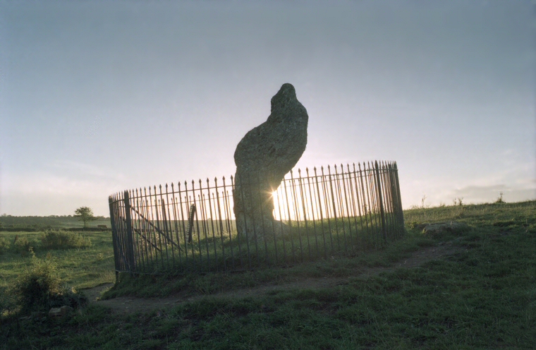
Men stone circle, the Whispering Knights burial chamber and the 2.5 metre tall curiously shaped limestone monolith of the King Stone, the only site of the group to stand in Warwickshire.
The King Stone is also the least well understood monument in the complex, single standing stones being notoriously difficult to date. It was once thought to have been an outlier to the stone circle (which probably dates to the late Neolithic or early Bronze Age between 2500-2000BC) but excavations of the site in 1983 revealed a round cairn within 5 metres of the stone, remnants from which were radiocarbon dated to about 1800BC. A round barrow a short distance away contained the cremated remains of a child and a collared urn, again a similar radiocarbon date of around 1770BC was obtained. Both dates are well into the Bronze Age.
It could be then that the King Stone was erected as a marker for a small barrow cemetery and was entirely unrelated to the King's Men stone circle. However author Aubrey Burl suggests that possibility that the outlier theory may be correct and that instead the barrow cemetery sprang up around what would already have been an ancient standing stone that was perhaps perceived as having some special significance.
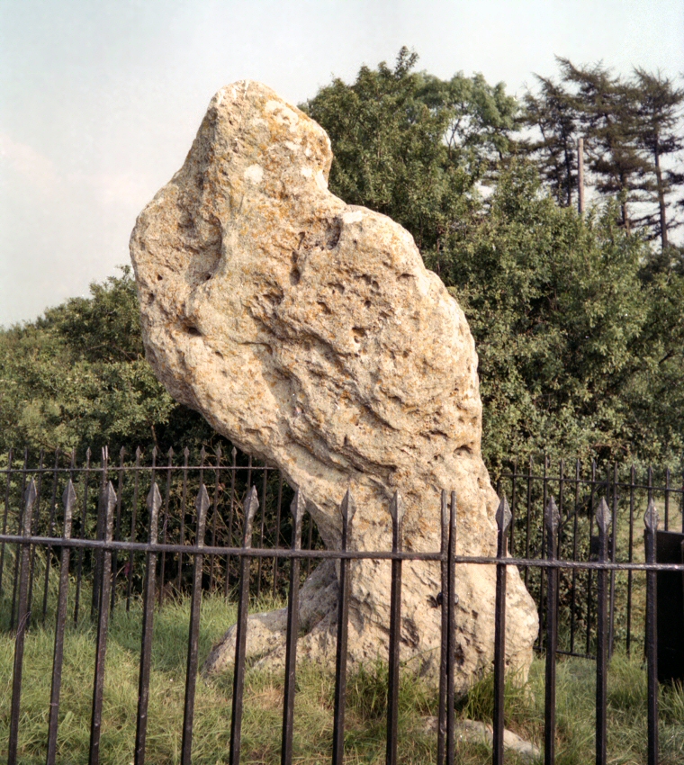
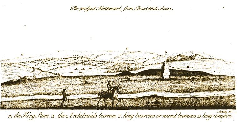
An old local legend says that fairies live underground nearby and come out at night to dance round the stone. William Stukeley writing in the mid 18th century also noted that at certain times of the year (midsummer) young men and women would meet at the King Stone and 'make merry with cakes and ale', probably little has changed in that respect although the shape of the stone certainly has. Stukeley describes it as both square and oblong, clearly different to its current form which is hollowed out on the lower east side, said to be the result of the 19th century tradition of chipping pieces of the stone off for good-luck charms. Arthur Evans says the locals blamed this damage squarely on Welsh drovers who also got the blame for the state of the highway as they 'used to trench the road with their cattle' before the railway way built. Given the possible age of the track that bisects the King Stone from the circle and burial chamber it is tempting to suggest a Welsh origin for some of the components of the Rollright complex.

The King Stone, the hollowed out section to the lower left is the result of people chipping off chunks for lucky amulets in the 19th century - probably the reason why the lethal looking fence was erected round the stone.

William Stukeley's illustration of the King Stone and some of the surrounding barrows at Rollright drawn in the mid 18th century, the King Stone is depicted as a much more regular shape than it is today. The 'Archdruid's Barrow' was thought by Stukeley to be a long barrow but is now known to be a natural feature.
Site Visits / Photographs:
June 1992, August 1997.
References:
Burl, A. 1976. The Stone Circles of the British Isles. London: Yale University Press.
Burl, A. 1979. Rings of Stone. London: Frances Lincoln Publishers Ltd.
Burl, A. 1995. A Guide to the Stone Circles of Britain, Ireland and Brittany. London: Yale University Press.
Camden, W. 1722. Britannia. Gibson Edition Vol 1. London.
Cope, J. 1998. The Modern Antiquarian. A Pre-Millennial Odyssey through Megalithic Britain. London: Thorsons.
Dyer, J. (Editor). 1993. Discovering Prehistoric England. Princes Risborough: Shire Publications Ltd.
Evans, A. 1895. The Rollright Stones and their Folklore. Folk-lore, Vol 6, 6-51.
Ferguson, J. 1872. Rude Stone Monuments in all Countries; their age and uses. London: Murray.
Plot, R. 1677. The Natural History of Oxfordshire. Oxford:
Stukeley, W. 1743. Abury, A Temple of the British Druids, with Some Others, Described. London
Historic England Research Records: Hob 968764.
NMR Number SP 23 SE 14 / 28160 (Rollright Stones).
Pastscape Monument Number 332813 (Rollright Stones).