
Stanton Drew
is a complex and baffling arrangement consisting of three late neolithic stone
circles, two avenues, and an associated group of stones refered to as the Cove. Add to this the nearby recumbent
stone known as Hautville's Quoit and you have a site that is as impressive
as it is unknown and secluded. Until recently only two of the circles
were accessible, now all three are open for the public to wander round
and try to make some kind of sense of the monument. A leaflet is available
at the entrance to the field that holds both the Great Circle and the Northeast
Circle but adds little to the visitors understanding as you walk between
sometimes massive blocks of sandstone, breccia and limestone, some standing,
some seemingly strewn around randomly (see plan at bottom of page). Only on reading and rereading of
various texts does the whole picture start to come together.
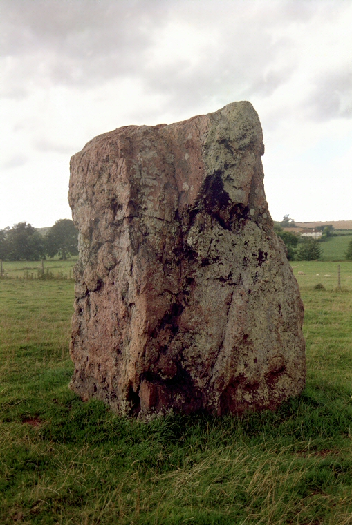
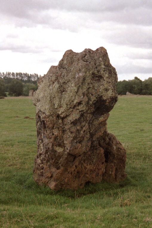
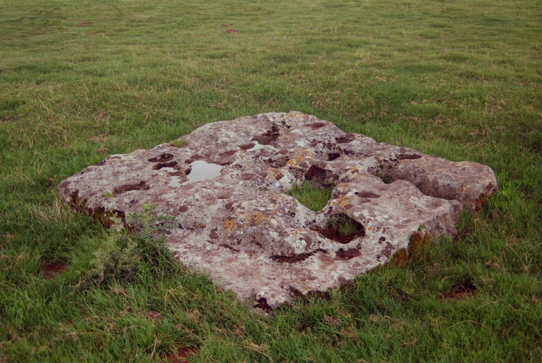
Starting in this large field we first find the Great Circle. A massive 113 metre true circle, the second largest in England after Avebury which originally consisted of between thirty and forty stones of which twenty-seven remain with only a handful still standing. Leading from the northeast of the circle are the shattered remains of a stone avenue which passes by the smaller Northeast Circle, shown above in summer 2000. This Northeast Circle is in fact slightly elliptical and contains eight stones, possibly the original total, of which four remain standing. What at first appears to be just a jumble of blocks just to the east of this much smaller 30 metre ring is in fact a second avenue, which would have joined the first and together would have continued down to the River Chew. Beyond the river, some 500 metres to the northeast of the Great Circle lies the fallen sarsen block of Hautvilles Quoit. Standing a short distance away from these circles in a different field to the southwest is the now accessible Southwest Circle containing eleven fallen stones of a possible original dozen stones (image below).
Geophysical surveying of the site in 1997 added new information to the Stanton Drew picture and altered the context of the stone circles. The Great Circle was found to be set within a massive henge monument whose ditch measured around 135 metres in diameter with an entrance to the northeast while within the circle a series of nine concentric rings of buried pits were discovered increasing in diameter from 23 metres to 95 metres. It is possible these pits could have held rings of wooden posts (see Woodhenge for a reconstruction of what a similar timber circle might have looked like). Presumably the henge and timber circles would have pre-dated the stone circle, the Great Circle being constructed as a permanent setting after the wooden posts rotted away and the henge ditch had started to silt up and its banks erode.
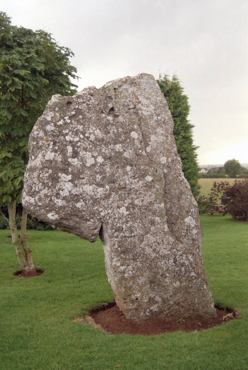
On the other side of the village, between the church and the Druid's Arms Inn is the mysterious Cove, this comprises of two standing stones, one looking like a huge prehistoric golf flag and a third recumbent slab lying between them. The purpose of these stones is unknown but a survey in 2009 sought to shed light on the suggestion that they formed part of the facade of a long barrow. Although the results were inconclusive, the theory could not be ruled out and if correct would mean the Cove was the founding monument of Stanton Drew and could predate the stones circles by as much as 1000 years. Interestingly there is an alignment from the Cove through the centres of the Great Circle and the Northeast Circle while a second alignment exists through the centres of the Southwest Circle and Great Circle towards Hautville's Quoit on the other side of the River Chew.
Sites like Stanton Drew always attract their share of legends and stories. It is said that the stone circles are a petrified wedding party who danced on into the Sabbath due to the mischievous Devil's fiddle playing. The bride, groom and parson tried to escape but they too were turned to stone, and now stand as The Cove. This story is similar to many other associated with circles and standing stones throughout the country, and like other sites, the stones of Stanton Drew are said to be uncountable.
Starting in this large field we first find the Great Circle. A massive 113 metre true circle, the second largest in England after Avebury which originally consisted of between thirty and forty stones of which twenty-seven remain with only a handful still standing. Leading from the northeast of the circle are the shattered remains of a stone avenue which passes by the smaller Northeast Circle, shown above in summer 2000. This Northeast Circle is in fact slightly elliptical and contains eight stones, possibly the original total, of which four remain standing. What at first appears to be just a jumble of blocks just to the east of this much smaller 30 metre ring is in fact a second avenue, which would have joined the first and together would have continued down to the River Chew. Beyond the river, some 500 metres to the northeast of the Great Circle lies the fallen sarsen block of Hautvilles Quoit. Standing a short distance away from these circles in a different field to the southwest is the now accessible Southwest Circle containing eleven fallen stones of a possible original dozen stones (image below).
Geophysical surveying of the site in 1997 added new information to the Stanton Drew picture and altered the context of the stone circles. The Great Circle was found to be set within a massive henge monument whose ditch measured around 135 metres in diameter with an entrance to the northeast while within the circle a series of nine concentric rings of buried pits were discovered increasing in diameter from 23 metres to 95 metres. It is possible these pits could have held rings of wooden posts (see Woodhenge for a reconstruction of what a similar timber circle might have looked like). Presumably the henge and timber circles would have pre-dated the stone circle, the Great Circle being constructed as a permanent setting after the wooden posts rotted away and the henge ditch had started to silt up and its banks erode.
On the other side of the village, between the church and the Druid's Arms Inn is the mysterious Cove, this comprises of two standing stones, one looking like a huge prehistoric golf flag and a third recumbent slab lying between them. The purpose of these stones is unknown but a survey in 2009 sought to shed light on the suggestion that they formed part of the facade of a long barrow. Although the results were inconclusive, the theory could not be ruled out and if correct would mean the Cove was the founding monument of Stanton Drew and could predate the stones circles by as much as 1000 years. Interestingly there is an alignment from the Cove through the centres of the Great Circle and the Northeast Circle while a second alignment exists through the centres of the Southwest Circle and Great Circle towards Hautville's Quoit on the other side of the River Chew.
Sites like Stanton Drew always attract their share of legends and stories. It is said that the stone circles are a petrified wedding party who danced on into the Sabbath due to the mischievous Devil's fiddle playing. The bride, groom and parson tried to escape but they too were turned to stone, and now stand as The Cove. This story is similar to many other associated with circles and standing stones throughout the country, and like other sites, the stones of Stanton Drew are said to be uncountable.

The Southwest Circle.

The three remaining stones of the Cove
Various stones at Stanton Drew. Click to see enlarged images as a slideshow.

Satellite view of Stanton Drew with a plan of the three circles and the remains of the avenues overlaid, stones marked red are still standing, white stones are fallen. From top to bottom the circles are - the Northeast Circle, the Great Circle, the Southwest Circle while the stones of the Cove stand about 150 metres to the west of the Southwest Circle. This image shows the close proximity of the site to the River Chew which can be seen at the top right.
Site Visit / Photographs:
August 2000.
References:
Barnatt, J. 1987. The Design and Distribution of Stone Circles in Britain... Thesis, (PhD). University of Sheffield.
Burl, A. 1976. The Stone Circles of the British Isles. London: Yale University Press.
Burl, A. 1995. A Guide to the Stone Circles of Britain, Ireland and Brittany. London: Yale University Press.
Cope, J. 1998. The Modern Antiquarian. A Pre-Millennial Odyssey through Megalithic Britain. London: Thorsons.
Dyer, J. (Editor). 1993. Discovering Prehistoric England. Princes Risborough: Shire Publications Ltd.
Gibson, A. 2005. Stonehenge and Timber Circles. New Edition. Stroud: Tempus Publishing Ltd.
Oswin, J., Richards, J., Sermon, R. 2009. Geophysical Survey at Stanton Drew, July 2009. www.bacas.org.uk.
Pastscape: 1475186, NMR Number: ST 56 SE 75..