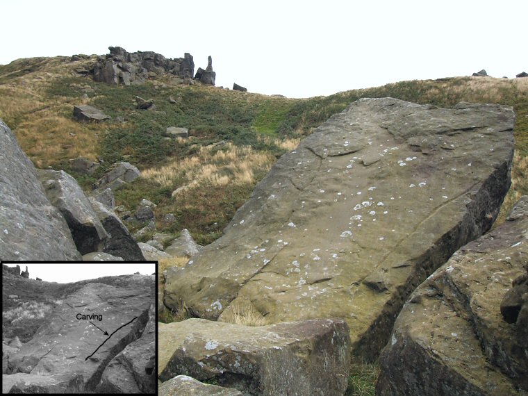
 Stone 5a at NZ55790364. The actual Wain Stones are the rock outcrop at the top left of the picture, stone 5a is located to the northwest of the outcrop and forms part of a jumble of large boulders close to a forestry track. |
|
The Wain Stones
are a distinctive rock outcrop popular with walkers and climbers that
is situated towards the northwestern edge of the Cleveland Hills, the
actual stones stand at the western end of Hasty Bank from which there
are fine and distant views north across to Middlesbrough and the Tees.
On the lower ground that surrounds the Wain Stones on three side is a small collection of carved rocks many of which show the signs of heavy erosion due to their exposed position. This erosion can make the designs difficult to work out even with the help of diagrams (I used the book 'Prehistoric Rock Art in the North York Moors' by Chappell & Brown on which the stone numbers are based) and some of the carvings eluded me completely. It does seem probable however that the location of these stones below and within sight of the Wain Stones points to this distinctive outcrop being a focus of activity in this area and it could be that the carved rocks are meant to venerate the outcrop in some way. Probable Date: Bronze Age |
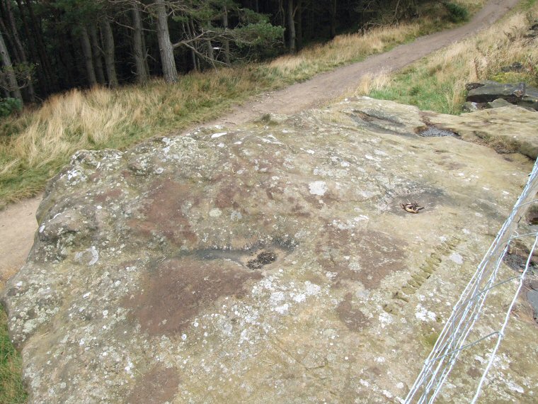 Stone 1 at NZ55630359. I found the carvings on this large eroded boulder difficult to make out with any certainty. In the lower middle of the photo a depression (with a dark patch in the centre) has a short dark groove leading to the left while above and to the right another depression (just above the graffiti) has a groove leading to the right and under the fence. To the right of this fence and off the edge of the shot are a couple of large irregularly shaped depressions that may contain cup marks. |
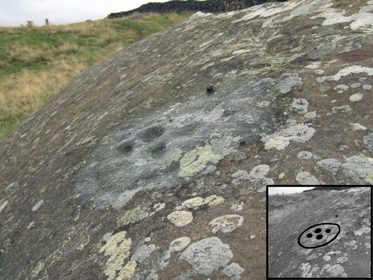 Stone 3a at NZ55590340. Another eroded carving this time on the upper right shoulder of a large boulder to the southwest of the Wain Stones. I've marked it with water to try to make it more clear, the interpretation in the bottom corner gives a better idea of the actual motif. |
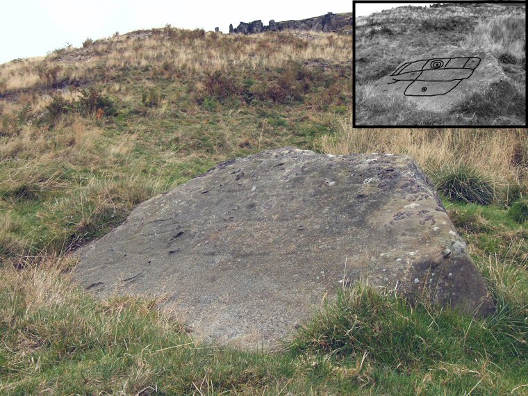 Stone 6a at NZ55840334. This flattened rock stands to the south of the Wain Stones which are visible at the top of the picture. It's quite a complex but worn design that shows evidence of the face of the rock being divided into zones, towards the top a cup can be seen that is surrounded by two or three worn rings with a further cup and ring appearing further down. This division of a flat surface into different areas reminded me of a stone at Woofa Enclosure on Rombalds Moor in West Yorkshire and it is tempting to speculate that it reflected an actual or imaginary division of the prehistoric landscape. |
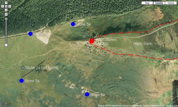 Satellite view showing the positions of the carved stones in relation to the main Wain Stones outcrop. It's easy to speculate that the arc of stones are focused on the outcrop itself. |
Back to Map | Home | Full Glossary | Links | Email: chriscollyer@stone-circles.org.uk