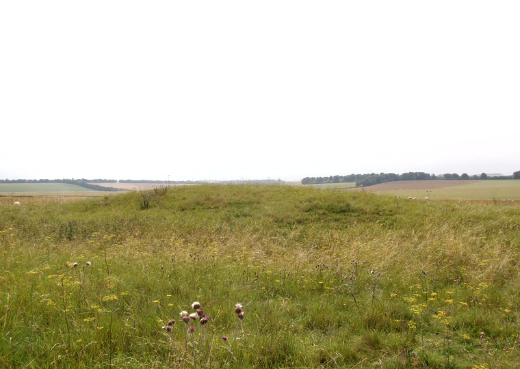
 Looking south over the enlarged eastern terminal of Wilsford 30 Long Barrow across Wilsford Down towards the Wilsford Group barrow cemetery hidden in the trees to the right of centre. |
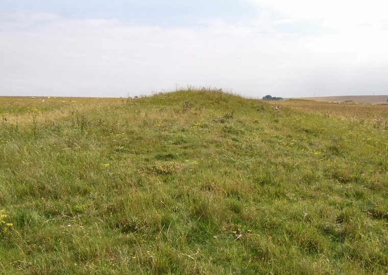
The monument known rather prosaically as Wilsford 30 is the remains of a Neolithic earthen long barrow located about 1.4 kilometres to the southwest of Stonehenge. It stands a short distance to the southwest of the main concentration of barrows of the Normanton Down group and is one of six Neolithic barrows that together with a mortuary enclosure form a loose cluster of monuments to the southwest of Stonehenge. Together they represent some of the earliest evidence of monument building in the area, predating the famous stones by at least a thousand years. Whereas the later barrow cemeteries that sprang up in the Stonehenge environ often have views towards (or from) Stonehenge the long barrow builders seemed to belong to a different tradition who were often more concerned with positioning their burial mounds just below the crests of hills that overlooked dry valleys or low lying ground. In the case of Wilsford 30 this seems to be the valley to the south formed by Wilsford Down and Spring Bottom. The barrow is oriented east to west and measures about 43 metres in length with an impressive enlarged eastern terminal that stands 2.3 metres tall and 22 metres wide at its base. The main body of the barrow tapers to a more modest 12 metres wide towards its western end although it has been somewhat damaged here by the track that runs southwest over Normanton Down. The ditches from which the earth and chalk for the barrow mound were quarried lay along its northern and southern flanks, the ditch to the north measures about 6 metres wide and despite being in-filled with some five millennia of earth is still up to a metre deep while the ditch to the south is five metres wide and survives to about half a metre deep. The addition of a narrow terrace about a metre wide along the southern side has lead to the suggestion that the barrow may have been modified in several stages, one of these stages may account for the enlargement of the eastern end of the mound. Wilsford 30 was excavated by Sir Richard Colt Hoare and William Cunnington in the early 19th century (which they numbered as Normanton 173) who found the well preserved skeletal remains of four people arranged together under the eastern terminal, one of whom Hoare noted 'seemed to have had no forehead, the sockets of his eyes appearing to have been on the top of his head'. What had caused this disfigurement is unknown. Another skeleton was also discovered just below the surface at the eastern end which has been interpreted as a secondary burial of the pagan Anglo Saxon era. |
 Looking east along the spine of the barrow towards the enlarged eastern terminal. |
Site Visits / Photographs: July 2011. References: Colt Hoare, R. 1812. The Ancient History of South Wiltshire. London: William Miller. Cunnington, M. 1914. List of the Long Barrows of Wiltshire. Wiltshire Archaeological & Natural History Magazine, 38, 405. Lawson, A. 2007. Chalkland: an archaeology of Stonehenge and its region. Salisbury: The Hobnob Press. Smith, M. and Brickley, M. 2009. People of the Long Barrows. Stroud: The History Press. Colt Hoare Number: Normanton 173, Pastscape 219705, NMR Number SU 14 SW 95. |