|
PRAND
= Prehistoric Rock Art in the Northern Dales, Paul & Barbara Brown
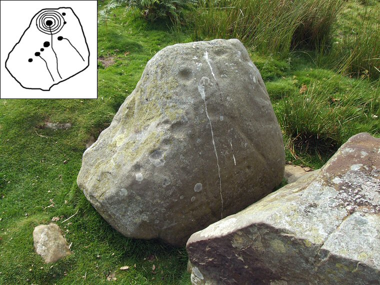
ERA = England's Rock Art, http://archaeologydataservice.ac.uk/era  BAR4 PRAND / ERA-819 / Barningham Moor 20 at NZ05470881. This upright boulder stands on low ground close to Scale Knoll Gill in the shadow of slightly higher ground to the northwest. A deep cup is surrounded by four eroded rings with a channel running down the face of the rock from the cup. Along the spine are a line of five cups, two of which also have channels or grooves emerging from them. |
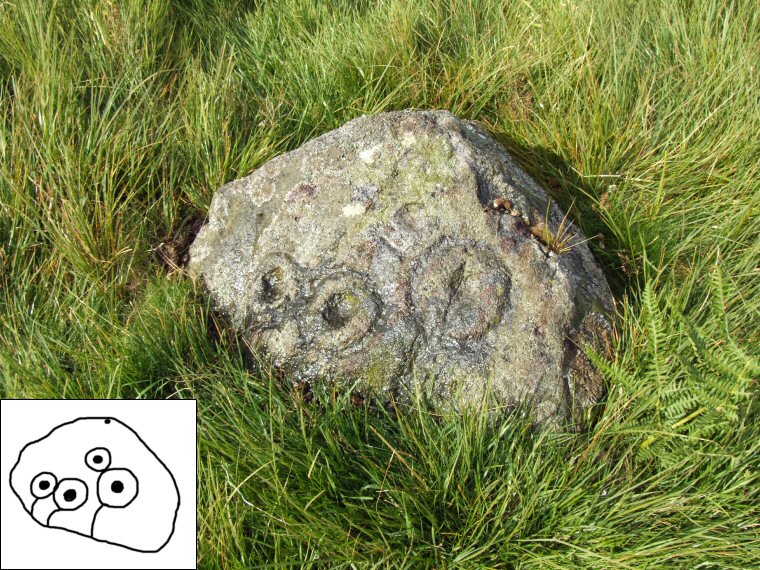
 BAR8 PRAND / ERA-812 / Barningham Moor 13 at NZ04990886. This is a small low pyramid shaped stone in an area of open moor and has four distinct cups each surrounded by well defined rings. The three lower rings have short gutters running down to ground level while there is a further cup and possible ring towards the top of the stone. |
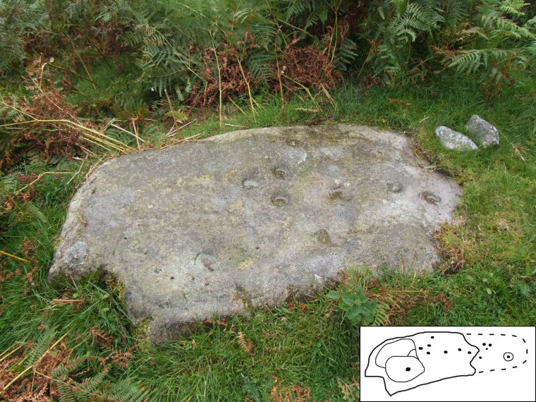
 BAR14b PRAND / ERA-805 / Barningham Moor 6 at NZ04560856. This flat rock lies at the western edge of the moor a short distance from a Forestry Commission plantation known as The Stang. Worn grooves form a zoned area to the left of the stone with the central area being made up of cups while a section under turf to the right has more cups and a well preserved cup and ring design. I hadn't realised this when I visited so the dotted area in the diagram is based on the plan of the rock in PRAND. |
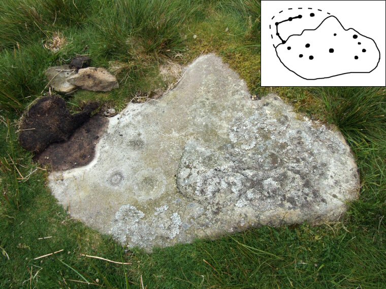
 BAR30 PRAND / ERA-823 / Barningham Moor 24 at NZ04450830. This stone also lies close to Forestry Commission land a little further to the south of BAR14b. The visible section has a scattering of cups while the partially un-turfed area has a line of cups that follow the edge of the stone, some of which are linked by a groove. |
Back to Map | Home | Full Glossary | Links | Email: chriscollyer@stone-circles.org.uk