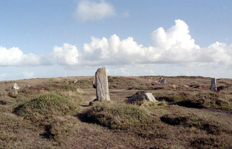
 Looking south over Boskednan Circle with the largest stone of the circle in the foreground. |
|
Boskednan stone circle
stands on a windswept southeast-northwest saddle of moorland in what local author and prehistorian Craig Wetherhill says 'could hardly be a lonelier spot'. To the southwest the land rapidly drops down into the valley of the Chyandour Brook as it makes its way to the sea less than 4 miles (6 kilometres) away at Penzance. Just over a mile (1.7 kilometres) across the valley and the settlement of Bodrifty to the east, Mulfra Hill and its Neolithic chambered tomb with collapsed capstone stands at a similar elevation to circle at around 220 metres above sea level while 800 metres away to the west on the hillside of another shallow valley is the mysterious stone setting of the Men-an-Tol. However it is distant hills that dominate the landscape at Boskednan. They sweep round in an arc from Boswens Common in the southwest to Chun Downs with its Iron Age hillfort and chambered tomb of Chun Quoit, Carn Downs to the west and round to Watch Croft and the rock outcrop of Carn Galver which looms on the horizon to the northwest. Unlike the more popular showpiece circles in Cornwall like the Merry Maidens and Boscawen-un, Boskednan is in a poor state of repair and this combined with its remote location well away from the tourist trail is probably the reason why it appears in far fewer guides to the area. What remains today is a 22 metre diameter granite ring consisting of seven standing stones, although a couple of these are leaning outwards from the centre while a further four fallen stones remain partly submerged in the encroaching heather with the ring having lost most of the stones of the north-eastern quadrant. The stones have their inner faces dressed smooth and measure between a metre and 1.5 metres tall except for a pair towards the north-northwest. One of these remains upright (in the foreground of the photograph above) and stands about 2 metres tall while a fallen stone adjacent to it probably stood to the same height. John Barnatt speculates that this pair could have formed an entrance portal to the circle and perhaps an alignment with the prominent Carn Galver which although it is an elongated, one kilometre long northwest-southeast outcrop, appears as a conical mound not unlike a small Silbury Hill on the horizon 1500 metres away when seen from the circle (photograph below). There is some uncertainty over how many stones originally stood at Boskednan, William Borlase who first recorded the site in 1754 noted nineteen stones, thirteen of which were standing with another six laying in position close to where they had fallen (see plan below). More recent interpretations put the total number of stones in the circle a little higher, Aubrey Burl calculates there were originally twenty-two stones while Barnatt says twenty-two or twenty-three. The loss of some of these stones may be accounted for by the proximity of the charmingly named Ding Dong copper mine and the trial prospecting for minerals, some of which took place within the circle itself. On the southern edge of the circle and slightly encroaching on it is a small round barrow or cairn that was investigated by William Copeland Borlase (a descendant of William Borlase) in 1872 when it was already in damaged state. Borlase recorded a rectangular slab lined cist that measured 1.2 metres by 75 cm floored with three further stone slabs set within the mound but its capstone had already been removed and the contents disturbed, this had probably occurred during an earlier investigation in 1848. Borlase could find no remains in the cist but found a sherd of a local pottery type known as Trevisker Ware nearby attributing it to having been smashed and 'carelessly thrown aside' by the previous investigators. Date: Bronze Age Update: In 2004 efforts were made to clear some of the scrub around the site and repair the footpaths. During the course of this work the sockets of two of the stones were located and the stones re-erected. Story from 'The Cornishman' reported here. |
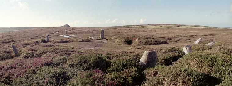 Looking northwest over Boskednan Circle with the outcrop of Carn Galver on the horizon to the left, photograph taken from the edge of the cairn |
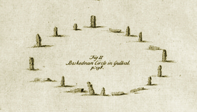 Three antiquarian views of Boskednan Circle. This first image was sketched by William Borlase and published in 1769. At that time thirteen stones were shown as still standing with six others fallen. |
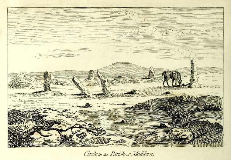 Boskednan Circle sketched by William Cotton and published in 1827. Cotton notes that seven stone were standing in his time with a further nine fallen stones on site. The view is looking west towards the later Iron Age hillfort of Chun Castle. |
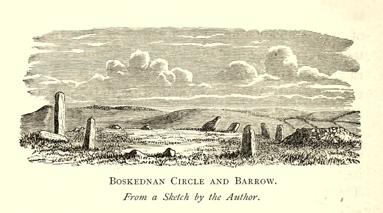 Boskednan Circle sketched by William Copeland Borlase (a decendant of the William Borlase above) and published in 1872. Borlase does a better job than Cotton in showing the cairn on the edge of the circle, unsuprising really as it was Borlase that excavated it. He recorded there were still seven stones standing but he could only find four of the fallen stones, although he appears to draw six in the illustration. View looking roughly east. |
Site Visits / Photographs: August 1999. References: Barnatt, J. 1987. The Design and Distribution of Stone Circles in Britain... Thesis, (PhD). University of Sheffield. Borlase, W. 1769. Antiquities, Historical and Monumental of the County of Cornwall. London: Borlase, W. C. 1872. Naenia Cornubiae A Descriptive Essay. London: Longmans.. Burl, A. 1976. The Stone Circles of the British Isles. London: Yale University Press. Burl, A. 1995. A Guide to the Stone Circles of Britain, Ireland and Brittany. London: Yale University Press. Cope, J. 1998. The Modern Antiquarian. A Pre-Millennial Odyssey through Megalithic Britain. London: Thorsons. Cotton, W. 1827. Illustrations of Stone Circles, Cromlechs ... in the West of Cornwall. London: Moyes. Weatherhill, C. 1981. Belerion. Ancient Sites of Land's End. Penzance: Alison Hodge. Weatherhill, C. 1985. Cornovia. Ancient Sites of Cornwall & Scilly. Penzance: Alison Hodge. Historic England Research Record Hob Uid: 423718, National Monuments Record Number: SW 43 NW 40. |