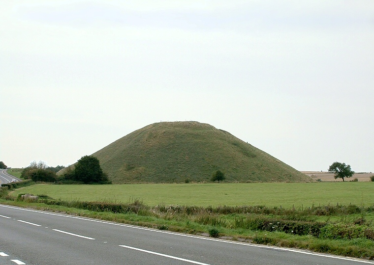
Silbury hill looking northwest from beside the A4 road.
The mysterious
Silbury Hill is the largest man-made prehistoric mound in Europe although
its original purpose has never been explained.
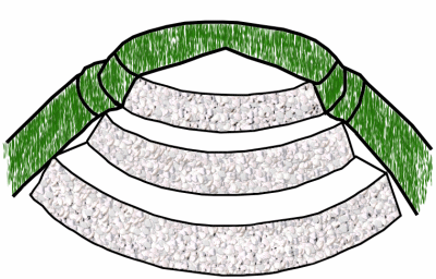
It has been estimated that it would have taken several million work-hours to construct using over 325000 cubic metres of chalk dug from a wide ditch around the base. Its dimensions are also impressive with a diameter that measures between 150-160 metres across the base and standing nearly 40 metres high with a wide flattened top and a prominent ledge visible near the summit which points to its method of construction.
Many people believed that Silbury contained a rich burial or treasure and over the years there have been several attempts to excavate various parts of the hill, notably by Colonel Drax who sunk a shaft down through the top in 1776 and Dean Merewether who bored a tunnel through the base in 1849 which was later re-excavated by Richard Atkinson in 1968, but there have been few finds.
Things changed after a partial collapse of the summit shaft in 2000 when it was decided that a programme of archaeological survey and work to strengthened the fragile structure of the mound should be undertaken, this survey work has thrown up some interesting results. Firstly radiocarbon dating of the old land surface returned a date of 2400BC which would put the initial phase of Silbury close to the end of the Neolithic but the final phases may not have occurred until the Bronze Age sometime around 2000BC.
It seems that the structure started out as three low mounds of gravel and turf which were later covered with a mixture of chalk, small sarsen blocks and earth and surrounded by a series of chalk banks and an external ditch. The excavators hence suggest that the monument originally started as some form of enclosure site.
Later further ditches were cut to provide the chalk used to create a series of higher and higher mounds and an unknown number of phases occurred where an ever widening circle of ditches were dug as the monument increased in both diameter and height until it reached its present form.
What still remains unanswered however is why the prehistoric population of the area felt the need to invest so much time and effort in constructing Silbury at all. This mystery is likely to go unsolved for the time being but it seems certain that we must take into account the many other prehistoric structures in the local area - the henge and circle of Avebury stands less than a mile to the north with the West Kennet Avenue passing to the northeast of Silbury to The Sanctuary at Overton Hill. To the southeast are the two long barrows of East and West Kennet while the causewayed enclosure of Windmill Hill, possibly the earliest structure in the Avebury landscape, stands about two miles to the northwest.

Diagram of the internal structure of Silbury Hill showing how it was constructed of chalk rubble in tiers like a wedding cake before being covered with earth. The top three tiers are shown, there are actually five or six such layers.