 Picture taken from the western terminal of the cursus looking east. The almost parallel course can be seen as the line of bushes and trees to the centre left and the line of hedges 100 metres away to the centre right. |
Like the Stonehenge
Avenue this monument was first recorded by the 18th century antiquarian
William
Stukeley. He imagined teams of Romans or Ancient Britons racing
chariots along its length and so gave it the name 'cursus',
the Latin for racecourse, a term which is now applied to all monuments
of this type. It is now known that cursus monuments are much older than
Stukeley believed and are thought to have been constructed in the middle
to late Neolithic
so it may be the Stonehenge Cursus is contemporary with the first phase
of construction at Stonehenge
itself which lies about 700 metres to the south of the central section
of the cursus. What can be seen on the ground today is very faint but its course and size can be clearly seen from the air. It consists of a pair of nearly parallel banks and outer ditches varying between 100 and 150 metres apart and traveling for a distance of around 2.75 km (1.7 miles) in an almost west to east direction across the northern Stonehenge landscape. Slight changes of direction, or kinks towards either end may suggest it was cut in several stages and enlarged during its lifespan. Although it is now just a low grass covered monument, when freshly cut from the underlying chalkland it would have created a striking bright white gash across the landscape. Just beyond the eastern end of the cursus is a neolithic long barrow oriented north to south (i.e. perpendicular to the cursus) and it has been speculated that the cursus was built as a processional trackway leading to this barrow. However if the axis of the cursus is extended further eastwards it passes by the now fallen Cuckoo Stone and through the timber circle of Woodhenge before reaching the River Avon and it could instead be that the cursus formed part of an east to west route from the river, perhaps symbolically from the realm of the living to that of the dead. Later during the Bronze Age several groups of round barrow were built close to, but not within the area enclosed by the cursus except for two barrows located within the western terminal, only one of which now remains (image below). When traveling in a west to east direction it is curious that the site of Stonehenge is initially not visible being blocked from view by a ridge of land crowned by the barrows of the Cursus Group cemetery. It is only once past this low ridge that the site comes into view and remains on the local horizon as the cursus dips into the northern section of Stonehenge Bottom before rising up again to its eastern terminal close to the modern Strangways estate. However it must be remembered that the cursus probably pre-dates the arrival of the stones at Stonehenge and the site may not have gained the importance it achieved in later years. What the purpose of the Stonehenge Cursus was remains a mystery, it seems it played an important role in the early story of the Stonehenge landscape perhaps relating to either physical or spiritual movement through a sacred landscape that would later become the focus of much barrow building activity in the Bronze Age. Studies of other cursuses suggest that they had fallen out of use by this time and it could be that by the time the mighty trilithons we see today at Stonehenge were erected the cursus had already become a largely ignored monument, a ghost in the landscape constructed for an unknown purpose by a forgotten people of the past. There was once a second narrower and shorter cursus a short distance to the northwest known as the Lesser Cursus but this has now been completely destroyed by ploughing. |
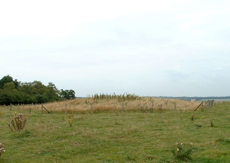 Round barrow within the western terminal of the cursus. |
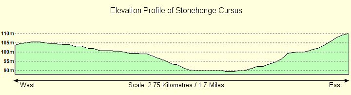 Profile of The Stonehenge Cursus running from West to East clearly showing it starts and ends on high ground and dips in Stonehenge Bottom roughly halfway along its length. |
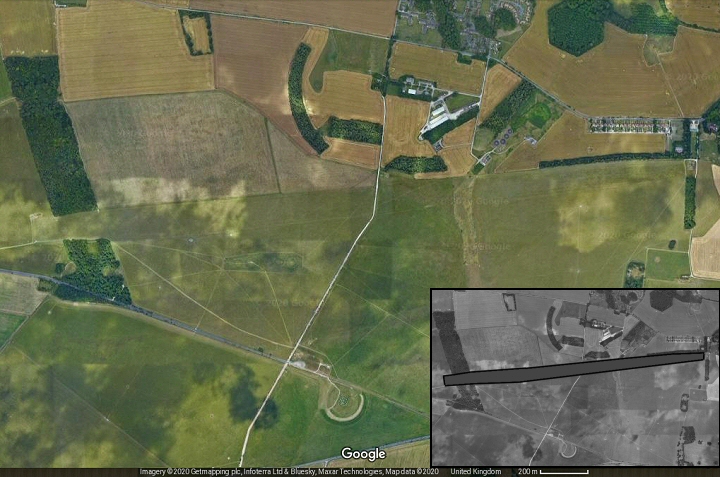 Satellite image of the Stonehenge Cursus. The Cursus starts just to the left of the gap in the trees (to the left of picture) and runs east to the line of trees on the right while Stonehenge is near the bottom centre (Cursus marked on the inset image). |