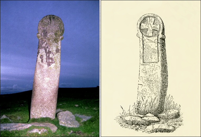
In his book 'Old Cornish Crosses' from 1896, Arthur Langdon gives the stone's dimensions as 2.9 metres tall, about 61cm wide at the base, 58cm at the top with the width of the head being 70cm and the depth of the stone being 30cm at the base, tapering to 23cm at the top. The flash photo on the left doesn't really show it but the head of this rather phallic looking stone is carved with a simple cross on both faces (drawing by Langdon right) and it forms one of several such Christian monuments on the moor (see also King Doniert's Stone), it is possible however that it has a much longer history.
Situated about 850 metres to the north-northeast are the three stone circles that make up The Hurlers and beyond them Rillaton Barrow. If a line is drawn from the Longstone to Rillaton then it would appear to pass through all three of the stone circles (at least on a 1:25000 map).
Alternatively, the early 20th century astronomer Sir Norman Lockyer was convinced the Longstone stood in alignment with the Hurlers but he suggested it acted as a sighting line from the southern circle to the sunset in February and November, which he proposed were important times of the year in what he believed to be a prehistoric May-November-May agricultural year.
These may just be coincidences but it could be that the Longstone is a Christianised prehistoric standing stone. The early church sometimes sought to appropriate pagan monuments rather than destroy them in an attempt to woo the heathen worshipers into the Christian faith (see Rudston Monolith). The Rev. Sabine Baring-Gould (who should know about such things) says that Saint Samson 'found the Cornish natives dancing around a tall stone, and he did not break it down; he contented himself with marking a cross on it'.
He then elaborates further on a similar practice taking place in Brittany, northwest France, saying 'In 658 a council assembled at Nantes decreed - "As in remote places and in woodlands there stand certain stones which the people often worship, and at which vows are made, and to which oblations are presented - we decree that they be all cast down and concealed in such a place that their worshippers may not be able to find them." Now the carrying out of their order was left to the country parsons, and partly because they had themselves been brought up to respect these stones, and partly because the execution of the decree would have brought down a storm upon their heads, they contented themselves with putting a cross on top of the stones.'
None of which proves the Longstone has a prehistoric origin but it provides intriguing speculation (I've suggested the same process may have taken place at the wheel cross of Maen Achwyfaen in Wales). Without excavation around the base of the stone, its true history may remain unresolved.
Site Visits / Photographs:
August 1997, August 1999.
References:
Baring-Gould, S. 1901. A Book of Brittany. London: Methuen.
Langdon, A. 1896. Old Cornish Crosses. Truro: Pollard.
Locker, N. 1906. Stonehenge... British Stone Monuments Astronomically Considered. London: Macmillan.
Historic England Research Records Hob Uid: 435761.
HER Number: 1410.
County Number: CO 167.
Scheduled Monument: 15164.