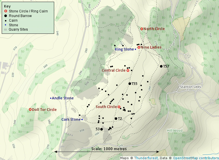
Map showing the distribution of sites on Stanton Moor (after Barnatt 1986).
Stanton Moor
is an area of upland standing to a height of between 280-320 metres above
sea level between the villages of Stanton in Peak to the
north and Birchover in the south. It forms an isolated outcrop of gritstone that together with Harthill Moor, just to the west over the Ivy Bar Brook, is cut off from the main upland area of East Moor by the valley of the mighty River Derwent to the east. The River Wye to the north and the valleys of a couple of small streams to the south conspire to make Stanton Moor a small island sandwiched between the grits of Dark Peak and the limestone plateau of the White Peak stretching away into the distance to the south and the west.
The Moor has been occupied since at least the Bronze Age and contains the remains of two definite stone circles (Nine Ladies and Doll Tor), three other possible circles or ring cairns (Stanton Moor North, Central and South), four round barrows and over seventy burial cairns as well as several curiously shaped natural standing stones and rock outcrops. Most of these sites lie on the eastern and southern slopes of the moor and have views across the Derwent and to the hills beyond but large scale stone quarrying along the western edge between the mid 19th and 20th centuries could have robbed us of many other unrecorded cairns or circles. For many years Stanton Moor was considered to be an area set aside almost exclusively for ritual and funeray purposes but recent survey work has suggested that somel areas of the Moor were perhaps devoted to farming and habitation. The largest of these areas so far discovered lies under much later Medieval fieldwalls to the west of the Central Circle and close to the edge of the old quarries so perhaps other
The sites have also received the attention of antiquarians and early archaeologists since Major Hayman Rooke in the late 18th century and Thomas Bateman and Llewellynn Jewitt in the 19th century. In the 20th century the father and son team of Joseph and Percy Heathcote conducted the excavation of about thirty sites on the Moor between the 1920's and 1930's although their sometimes 'idiosyncratic' reconstructions may have hindered our understanding of the original form of some of the monuments.
Much of what remains is now covered in thick layers of heather while increasing visitor numbers have lead to erosion on the moor particularly around the area of the Nine Ladies which has lead to the site being resurfaced with new turf. The Nine Ladies has also been threatened in the past by proposals to reopen nearby stone quarries which could have had irreversible effects on the circle and the surrounding moorland, currently however (2006), it would seem that these quarrying plans have been abandoned.
Featured sites:
Nine Ladies Stone Circle, North Stone Circle, Central Ring Cairn, South Stone Circle
Doll Tor Stone Circle also further west on Harthill Moor - Nine Stone Close stone circle.
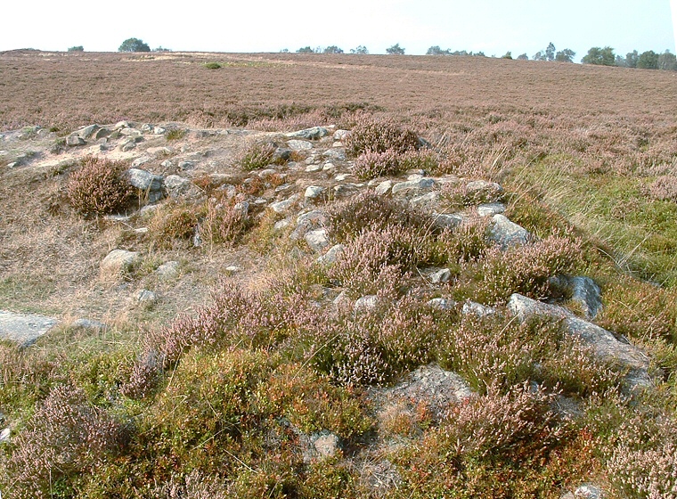
Part of the bank of barrow T2, one of the most prominent monuments on the moor.
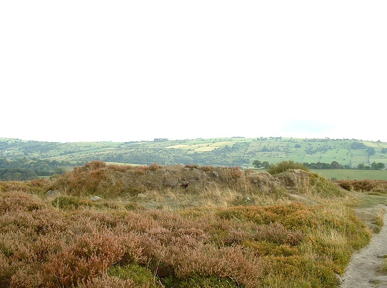
Remains of barrow T55 which measures over 16 metres in diameter.
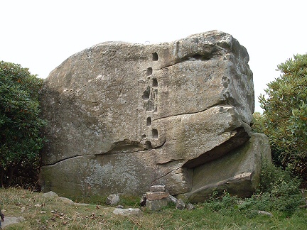
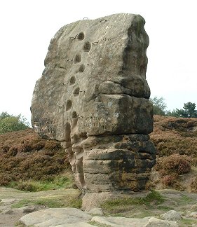
Left: The Andle Stone. This natural
outcrop has several large cup marks or basins on its top.
Right: The Cork Stone, a natural rock feature.
Right: The Cork Stone, a natural rock feature.
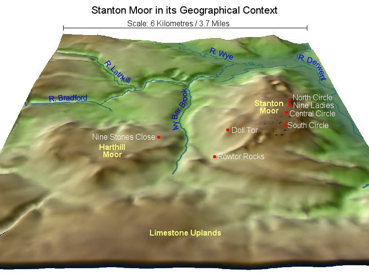 3D elevation map of Stanton Moor in its Geographical landscape context also showing the plateau of Harthill Moor to the west on the other side of the Ivy Bar Brook and with some of the major prehistoric sites listed in white.
The distance across the top of the map is about 6 Kilometres or 3.7 Miles.
References:
Ainsworth, S. 2001. Prehistoric Settlement Remains on the Derbshire Gritstone Moors. D.A.J., Vol 121, 19-69.
Barnatt, J. 1978. Stone Circles of the Peak. London: Turnstone Books.
Barnatt, J. 1986. Bronze Age remains on the East Moors of the Peak District. D.A.J., Vol 106, 18-100.
Bartlett, J. 1981. Obituary: Mr. J. P. Heathcote M.A., F.S.A.. Derbyshire Archaeological Journal, Vol. 101, 5-6.
Bateman, T. 1848. Vestiges of the Antiquities of Derbyshire. London: John Russell Smith.
Jewitt, L. 1870. Grave-mounds and their Contents: A Manual of Archaeology. London: Groombridge.
McGuire, S. and Smith, K. 2007. Stanton Moor Conservation Plan 2007. Peak District National Park Authority.
Morgan, V. and Morgan, P. 2001. Rock around the Peak. Wilmslow: Sigma Leisure.
Rooke, H. 1782. An account of some Druidical Remains on Stanton and Hartle Moor. Archaeologia, 6, 110-115.