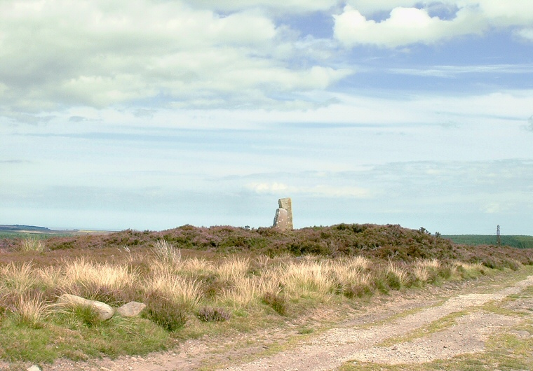
 Flass Brow barrow looking east
It measures about 10-12 metres in diameter but less than a metre high with a pair of stones placed on top of it. It has been suggested that the tallest of these stones may have a prehistoric origin but due to the fact that at least one side and face have been carved makes this hard to verify. The face also bears the inscription 'Sneaton Libert (?) Assize 1784'
If Flass Brow is indeed a barrow then it forms part of a chain of similar monuments that runs for nearly 7 miles from Black Brow in the north to the head of the valley of Stockland Beck in the southeast and it could be these barrows formed part of a territorial boundary. The chain includes Flat Howes, Pen Howes, Breckon Howe, Sil Howe, Flass Brow, Robbed Howe, Foster Howes, Ann Howe, Louven Howe, Lilla Howe, High Woof Howe and Low Woof Howe.
Possible Date: Bronze Age